You are here: Home > Network List > IW - Intermountain West Stations List
> Station MOOW Moose Ponds, Wyoming, USA > Earthquake Result Viewer
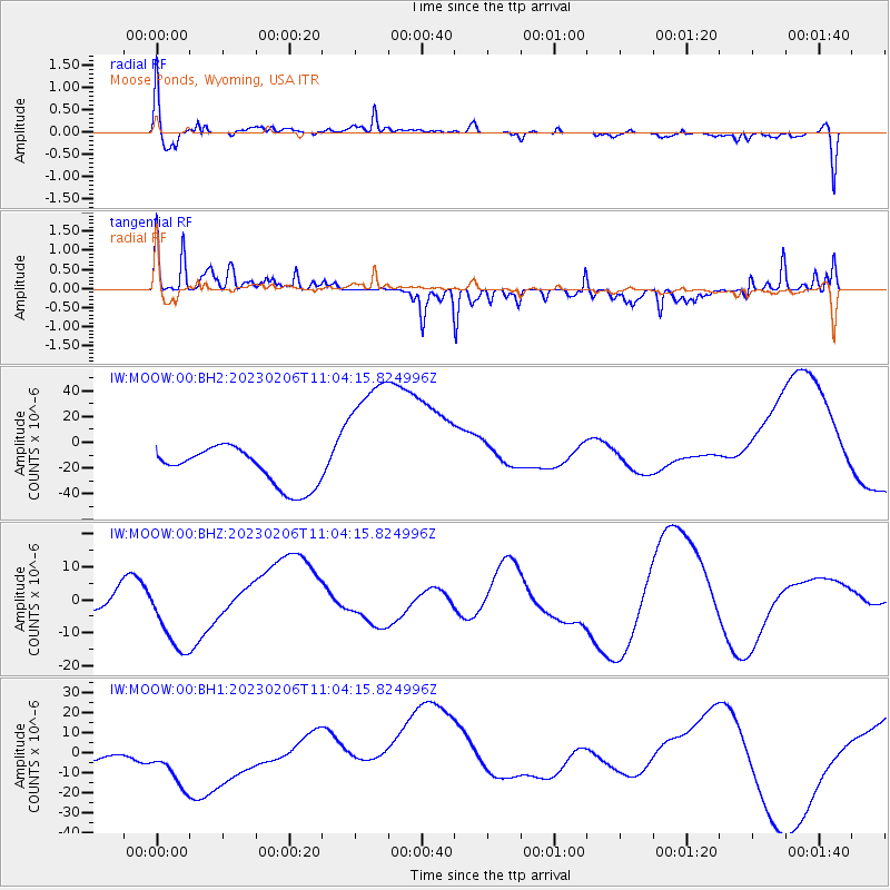
MOOW Moose Ponds, Wyoming, USA - Earthquake Result Viewer
*The percent match for this event was below the threshold and hence no stack was calculated.
| Earthquake location: |
Turkey |
| Earthquake latitude/longitude: |
38.1/38.1 |
| Earthquake time(UTC): |
2023/02/06 (037) 10:51:30 GMT |
| Earthquake Depth: |
12 km |
| Earthquake Magnitude: |
5.7 mb |
| Earthquake Catalog/Contributor: |
NEIC PDE/us |
|
| Network: |
IW Intermountain West |
| Station: |
MOOW Moose Ponds, Wyoming, USA |
| Lat/Lon: |
43.75 N/110.74 W |
| Elevation: |
2128 m |
|
| Distance: |
93.7 deg |
| Az: |
337.899 deg |
| Baz: |
24.171 deg |
| Ray Param: |
$rayparam |
*The percent match for this event was below the threshold and hence was not used in the summary stack. |
|
| Radial Match: |
52.84434 % |
| Radial Bump: |
400 |
| Transverse Match: |
69.955475 % |
| Transverse Bump: |
350 |
| SOD ConfigId: |
29823551 |
| Insert Time: |
2023-02-20 11:48:02.842 +0000 |
| GWidth: |
2.5 |
| Max Bumps: |
400 |
| Tol: |
0.001 |
|
Signal To Noise
| Channel | StoN | STA | LTA |
| IW:MOOW:00:BHZ:20230206T11:04:15.824996Z | 2.6672425 | 1.2942812E-5 | 4.852506E-6 |
| IW:MOOW:00:BH1:20230206T11:04:15.824996Z | 1.5312308 | 2.183409E-5 | 1.4259177E-5 |
| IW:MOOW:00:BH2:20230206T11:04:15.824996Z | 3.8591428 | 5.613676E-5 | 1.4546432E-5 |
| Arrivals |
| Ps | |
| PpPs | |
| PsPs/PpSs | |


