You are here: Home > Network List > US - United States National Seismic Network Stations List
> Station LAO LASA Array, Montana, USA > Earthquake Result Viewer
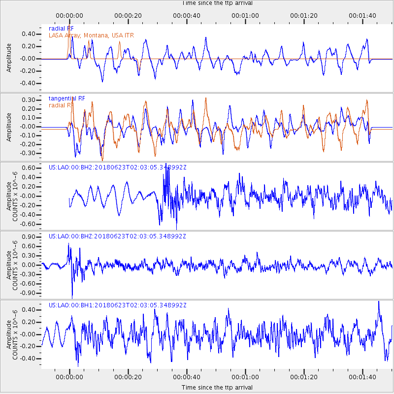
LAO LASA Array, Montana, USA - Earthquake Result Viewer
*The percent match for this event was below the threshold and hence no stack was calculated.
| Earthquake location: |
Near Coast Of Venezuela |
| Earthquake latitude/longitude: |
10.8/-62.6 |
| Earthquake time(UTC): |
2018/06/23 (174) 01:54:42 GMT |
| Earthquake Depth: |
106 km |
| Earthquake Magnitude: |
5.1 Mww |
| Earthquake Catalog/Contributor: |
NEIC PDE/us |
|
| Network: |
US United States National Seismic Network |
| Station: |
LAO LASA Array, Montana, USA |
| Lat/Lon: |
46.69 N/106.22 W |
| Elevation: |
902 m |
|
| Distance: |
51.4 deg |
| Az: |
322.571 deg |
| Baz: |
119.824 deg |
| Ray Param: |
$rayparam |
*The percent match for this event was below the threshold and hence was not used in the summary stack. |
|
| Radial Match: |
52.162857 % |
| Radial Bump: |
400 |
| Transverse Match: |
48.98485 % |
| Transverse Bump: |
400 |
| SOD ConfigId: |
2973751 |
| Insert Time: |
2018-10-09 14:08:32.277 +0000 |
| GWidth: |
2.5 |
| Max Bumps: |
400 |
| Tol: |
0.001 |
|
Signal To Noise
| Channel | StoN | STA | LTA |
| US:LAO:00:BHZ:20180623T02:03:05.348992Z | 5.914887 | 3.469001E-7 | 5.8648645E-8 |
| US:LAO:00:BH1:20180623T02:03:05.348992Z | 1.5318643 | 2.049948E-7 | 1.3382048E-7 |
| US:LAO:00:BH2:20180623T02:03:05.348992Z | 2.0541303 | 3.1615747E-7 | 1.5391305E-7 |
| Arrivals |
| Ps | |
| PpPs | |
| PsPs/PpSs | |


