You are here: Home > Network List > NE - New England Seismic Network Stations List
> Station EMMW Machias, ME, USA > Earthquake Result Viewer
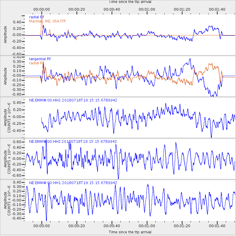
EMMW Machias, ME, USA - Earthquake Result Viewer
*The percent match for this event was below the threshold and hence no stack was calculated.
| Earthquake location: |
Alaska Peninsula |
| Earthquake latitude/longitude: |
54.4/-160.7 |
| Earthquake time(UTC): |
2018/07/18 (199) 19:06:03 GMT |
| Earthquake Depth: |
28 km |
| Earthquake Magnitude: |
5.6 Mww |
| Earthquake Catalog/Contributor: |
NEIC PDE/us |
|
| Network: |
NE New England Seismic Network |
| Station: |
EMMW Machias, ME, USA |
| Lat/Lon: |
44.71 N/67.46 W |
| Elevation: |
35 m |
|
| Distance: |
57.0 deg |
| Az: |
58.118 deg |
| Baz: |
315.871 deg |
| Ray Param: |
$rayparam |
*The percent match for this event was below the threshold and hence was not used in the summary stack. |
|
| Radial Match: |
37.841206 % |
| Radial Bump: |
400 |
| Transverse Match: |
36.9969 % |
| Transverse Bump: |
400 |
| SOD ConfigId: |
2973751 |
| Insert Time: |
2018-10-09 15:09:43.358 +0000 |
| GWidth: |
2.5 |
| Max Bumps: |
400 |
| Tol: |
0.001 |
|
Signal To Noise
| Channel | StoN | STA | LTA |
| NE:EMMW:00:HHZ:20180718T19:15:15.678994Z | 1.8473364 | 2.864622E-7 | 1.550677E-7 |
| NE:EMMW:00:HH1:20180718T19:15:15.678994Z | 1.1972857 | 1.9487887E-7 | 1.6276724E-7 |
| NE:EMMW:00:HH2:20180718T19:15:15.678994Z | 1.216367 | 1.7295594E-7 | 1.4219057E-7 |
| Arrivals |
| Ps | |
| PpPs | |
| PsPs/PpSs | |


