You are here: Home > Network List > US - United States National Seismic Network Stations List
> Station AGMN Agassiz National Wildlife Refuge, Minnesota, USA > Earthquake Result Viewer
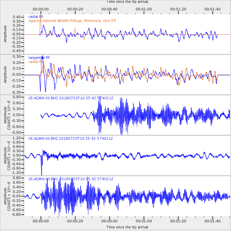
AGMN Agassiz National Wildlife Refuge, Minnesota, USA - Earthquake Result Viewer
*The percent match for this event was below the threshold and hence no stack was calculated.
| Earthquake location: |
Santiago Del Estero Prov., Arg. |
| Earthquake latitude/longitude: |
-28.1/-63.3 |
| Earthquake time(UTC): |
2018/07/20 (201) 10:24:57 GMT |
| Earthquake Depth: |
588 km |
| Earthquake Magnitude: |
5.6 Mww |
| Earthquake Catalog/Contributor: |
NEIC PDE/us |
|
| Network: |
US United States National Seismic Network |
| Station: |
AGMN Agassiz National Wildlife Refuge, Minnesota, USA |
| Lat/Lon: |
48.30 N/95.86 W |
| Elevation: |
351 m |
|
| Distance: |
81.5 deg |
| Az: |
338.661 deg |
| Baz: |
151.213 deg |
| Ray Param: |
$rayparam |
*The percent match for this event was below the threshold and hence was not used in the summary stack. |
|
| Radial Match: |
48.741413 % |
| Radial Bump: |
400 |
| Transverse Match: |
80.98044 % |
| Transverse Bump: |
400 |
| SOD ConfigId: |
2973751 |
| Insert Time: |
2018-10-09 15:21:46.132 +0000 |
| GWidth: |
2.5 |
| Max Bumps: |
400 |
| Tol: |
0.001 |
|
Signal To Noise
| Channel | StoN | STA | LTA |
| US:AGMN:00:BHZ:20180720T10:35:42.574021Z | 3.3190534 | 3.2044477E-7 | 9.654703E-8 |
| US:AGMN:00:BH1:20180720T10:35:42.574021Z | 3.4723911 | 2.5051312E-7 | 7.214427E-8 |
| US:AGMN:00:BH2:20180720T10:35:42.574021Z | 6.050687 | 3.5400214E-7 | 5.8506107E-8 |
| Arrivals |
| Ps | |
| PpPs | |
| PsPs/PpSs | |


