You are here: Home > Network List > UW - Pacific Northwest Regional Seismic Network Stations List
> Station WOLL Wollman Farm, Schrag, WA, USA > Earthquake Result Viewer
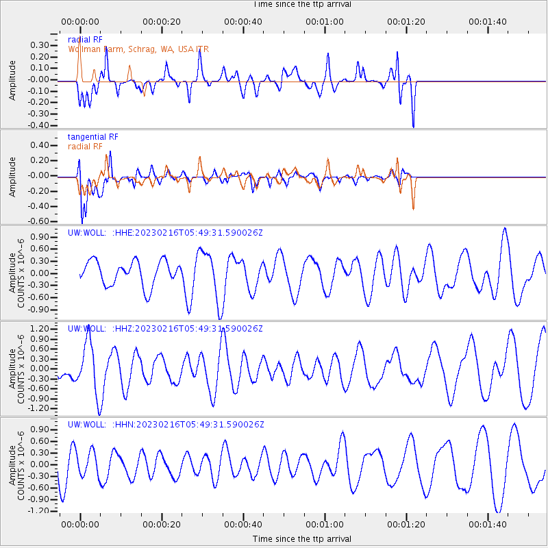
WOLL Wollman Farm, Schrag, WA, USA - Earthquake Result Viewer
*The percent match for this event was below the threshold and hence no stack was calculated.
| Earthquake location: |
Vanuatu Islands |
| Earthquake latitude/longitude: |
-15.1/167.0 |
| Earthquake time(UTC): |
2023/02/16 (047) 05:37:05 GMT |
| Earthquake Depth: |
36 km |
| Earthquake Magnitude: |
5.6 Mww |
| Earthquake Catalog/Contributor: |
NEIC PDE/us |
|
| Network: |
UW Pacific Northwest Regional Seismic Network |
| Station: |
WOLL Wollman Farm, Schrag, WA, USA |
| Lat/Lon: |
47.06 N/118.92 W |
| Elevation: |
385 m |
|
| Distance: |
90.4 deg |
| Az: |
41.103 deg |
| Baz: |
248.246 deg |
| Ray Param: |
$rayparam |
*The percent match for this event was below the threshold and hence was not used in the summary stack. |
|
| Radial Match: |
49.50188 % |
| Radial Bump: |
400 |
| Transverse Match: |
62.59872 % |
| Transverse Bump: |
400 |
| SOD ConfigId: |
29823551 |
| Insert Time: |
2023-03-02 05:53:05.201 +0000 |
| GWidth: |
2.5 |
| Max Bumps: |
400 |
| Tol: |
0.001 |
|
Signal To Noise
| Channel | StoN | STA | LTA |
| UW:WOLL: :HHZ:20230216T05:49:31.590026Z | 2.4881527 | 7.9253556E-7 | 3.185237E-7 |
| UW:WOLL: :HHN:20230216T05:49:31.590026Z | 0.80616635 | 3.0152123E-7 | 3.740186E-7 |
| UW:WOLL: :HHE:20230216T05:49:31.590026Z | 2.1672685 | 6.410242E-7 | 2.9577515E-7 |
| Arrivals |
| Ps | |
| PpPs | |
| PsPs/PpSs | |


