You are here: Home > Network List > AV - Alaska Volcano Observatory Stations List
> Station MAPS Pakushin Southeast, Makushin Volcano, Alaska > Earthquake Result Viewer
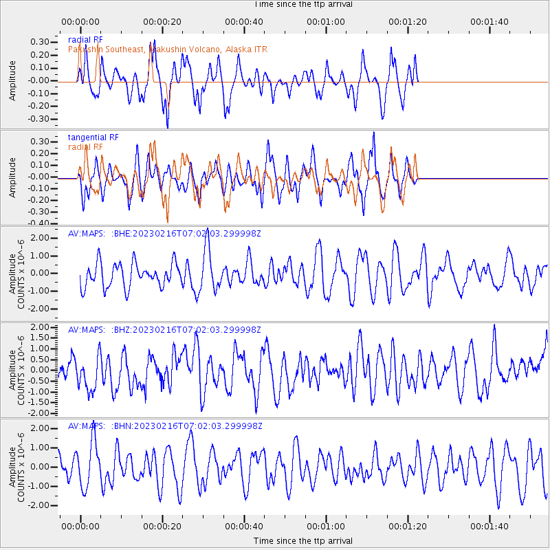
MAPS Pakushin Southeast, Makushin Volcano, Alaska - Earthquake Result Viewer
*The percent match for this event was below the threshold and hence no stack was calculated.
| Earthquake location: |
Haiti Region |
| Earthquake latitude/longitude: |
19.6/-73.7 |
| Earthquake time(UTC): |
2023/02/16 (047) 06:50:46 GMT |
| Earthquake Depth: |
14 km |
| Earthquake Magnitude: |
5.4 mww |
| Earthquake Catalog/Contributor: |
NEIC PDE/us |
|
| Network: |
AV Alaska Volcano Observatory |
| Station: |
MAPS Pakushin Southeast, Makushin Volcano, Alaska |
| Lat/Lon: |
53.81 N/166.94 W |
| Elevation: |
333 m |
|
| Distance: |
76.3 deg |
| Az: |
322.442 deg |
| Baz: |
75.68 deg |
| Ray Param: |
$rayparam |
*The percent match for this event was below the threshold and hence was not used in the summary stack. |
|
| Radial Match: |
59.895973 % |
| Radial Bump: |
316 |
| Transverse Match: |
65.776695 % |
| Transverse Bump: |
372 |
| SOD ConfigId: |
29823551 |
| Insert Time: |
2023-03-02 06:54:00.182 +0000 |
| GWidth: |
2.5 |
| Max Bumps: |
400 |
| Tol: |
0.001 |
|
Signal To Noise
| Channel | StoN | STA | LTA |
| AV:MAPS: :BHZ:20230216T07:02:03.299998Z | 1.3518361 | 9.128579E-7 | 6.7527264E-7 |
| AV:MAPS: :BHN:20230216T07:02:03.299998Z | 1.230317 | 1.2142702E-6 | 9.869573E-7 |
| AV:MAPS: :BHE:20230216T07:02:03.299998Z | 1.8118058 | 1.2101001E-6 | 6.678972E-7 |
| Arrivals |
| Ps | |
| PpPs | |
| PsPs/PpSs | |


