You are here: Home > Network List > AK - Alaska Regional Network Stations List
> Station GAMB Gambell Broadband > Earthquake Result Viewer
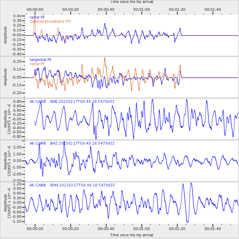
GAMB Gambell Broadband - Earthquake Result Viewer
*The percent match for this event was below the threshold and hence no stack was calculated.
| Earthquake location: |
Tanimbar Islands Reg., Indonesia |
| Earthquake latitude/longitude: |
-6.6/132.1 |
| Earthquake time(UTC): |
2023/02/17 (048) 09:37:34 GMT |
| Earthquake Depth: |
39 km |
| Earthquake Magnitude: |
6.1 Mww |
| Earthquake Catalog/Contributor: |
NEIC PDE/us |
|
| Network: |
AK Alaska Regional Network |
| Station: |
GAMB Gambell Broadband |
| Lat/Lon: |
63.78 N/171.70 W |
| Elevation: |
10 m |
|
| Distance: |
81.8 deg |
| Az: |
21.908 deg |
| Baz: |
236.549 deg |
| Ray Param: |
$rayparam |
*The percent match for this event was below the threshold and hence was not used in the summary stack. |
|
| Radial Match: |
55.84041 % |
| Radial Bump: |
400 |
| Transverse Match: |
35.03863 % |
| Transverse Bump: |
400 |
| SOD ConfigId: |
29823551 |
| Insert Time: |
2023-03-03 09:39:09.392 +0000 |
| GWidth: |
2.5 |
| Max Bumps: |
400 |
| Tol: |
0.001 |
|
Signal To Noise
| Channel | StoN | STA | LTA |
| AK:GAMB: :BHZ:20230217T09:49:18.547993Z | 2.8526917 | 1.0447926E-6 | 3.66248E-7 |
| AK:GAMB: :BHN:20230217T09:49:18.547993Z | 2.0420368 | 3.937279E-7 | 1.9281138E-7 |
| AK:GAMB: :BHE:20230217T09:49:18.547993Z | 1.4728956 | 4.5784915E-7 | 3.108497E-7 |
| Arrivals |
| Ps | |
| PpPs | |
| PsPs/PpSs | |


