You are here: Home > Network List > AK - Alaska Regional Network Stations List
> Station MDM Murphy Dome > Earthquake Result Viewer
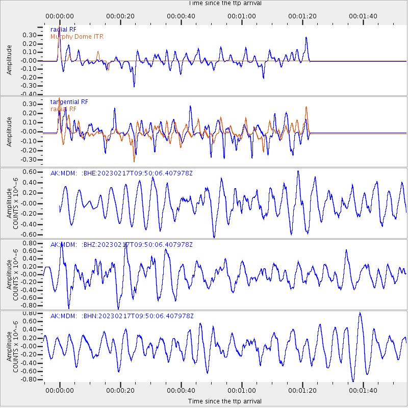
MDM Murphy Dome - Earthquake Result Viewer
*The percent match for this event was below the threshold and hence no stack was calculated.
| Earthquake location: |
Tanimbar Islands Reg., Indonesia |
| Earthquake latitude/longitude: |
-6.6/132.1 |
| Earthquake time(UTC): |
2023/02/17 (048) 09:37:34 GMT |
| Earthquake Depth: |
39 km |
| Earthquake Magnitude: |
6.1 Mww |
| Earthquake Catalog/Contributor: |
NEIC PDE/us |
|
| Network: |
AK Alaska Regional Network |
| Station: |
MDM Murphy Dome |
| Lat/Lon: |
64.96 N/148.23 W |
| Elevation: |
634 m |
|
| Distance: |
91.6 deg |
| Az: |
24.765 deg |
| Baz: |
257.908 deg |
| Ray Param: |
$rayparam |
*The percent match for this event was below the threshold and hence was not used in the summary stack. |
|
| Radial Match: |
64.14651 % |
| Radial Bump: |
400 |
| Transverse Match: |
69.16911 % |
| Transverse Bump: |
378 |
| SOD ConfigId: |
29823551 |
| Insert Time: |
2023-03-03 09:39:55.689 +0000 |
| GWidth: |
2.5 |
| Max Bumps: |
400 |
| Tol: |
0.001 |
|
Signal To Noise
| Channel | StoN | STA | LTA |
| AK:MDM: :BHZ:20230217T09:50:06.407978Z | 2.5487983 | 4.6311143E-7 | 1.8169796E-7 |
| AK:MDM: :BHN:20230217T09:50:06.407978Z | 0.81796986 | 1.675968E-7 | 2.0489362E-7 |
| AK:MDM: :BHE:20230217T09:50:06.407978Z | 1.5048075 | 3.202393E-7 | 2.1281082E-7 |
| Arrivals |
| Ps | |
| PpPs | |
| PsPs/PpSs | |


