You are here: Home > Network List > IU - Global Seismograph Network (GSN - IRIS/USGS) Stations List
> Station PMG Port Moresby, New Guinea > Earthquake Result Viewer
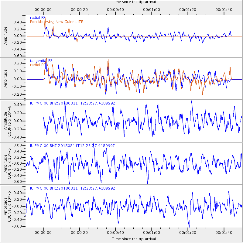
PMG Port Moresby, New Guinea - Earthquake Result Viewer
*The percent match for this event was below the threshold and hence no stack was calculated.
| Earthquake location: |
West Of Macquarie Island |
| Earthquake latitude/longitude: |
-55.1/146.5 |
| Earthquake time(UTC): |
2018/08/11 (223) 12:15:36 GMT |
| Earthquake Depth: |
10 km |
| Earthquake Magnitude: |
5.4 mb |
| Earthquake Catalog/Contributor: |
NEIC PDE/us |
|
| Network: |
IU Global Seismograph Network (GSN - IRIS/USGS) |
| Station: |
PMG Port Moresby, New Guinea |
| Lat/Lon: |
9.40 S/147.16 E |
| Elevation: |
90 m |
|
| Distance: |
45.6 deg |
| Az: |
0.866 deg |
| Baz: |
180.504 deg |
| Ray Param: |
$rayparam |
*The percent match for this event was below the threshold and hence was not used in the summary stack. |
|
| Radial Match: |
53.708763 % |
| Radial Bump: |
400 |
| Transverse Match: |
51.3807 % |
| Transverse Bump: |
400 |
| SOD ConfigId: |
2973751 |
| Insert Time: |
2018-10-09 16:35:11.395 +0000 |
| GWidth: |
2.5 |
| Max Bumps: |
400 |
| Tol: |
0.001 |
|
Signal To Noise
| Channel | StoN | STA | LTA |
| IU:PMG:00:BHZ:20180811T12:23:27.418999Z | 2.1095881 | 2.778854E-7 | 1.3172495E-7 |
| IU:PMG:00:BH1:20180811T12:23:27.418999Z | 1.4900981 | 2.2304145E-7 | 1.4968239E-7 |
| IU:PMG:00:BH2:20180811T12:23:27.418999Z | 0.6563878 | 1.0468887E-7 | 1.5949242E-7 |
| Arrivals |
| Ps | |
| PpPs | |
| PsPs/PpSs | |


