You are here: Home > Network List > US - United States National Seismic Network Stations List
> Station CBKS Cedar Bluff, Kansas, USA > Earthquake Result Viewer
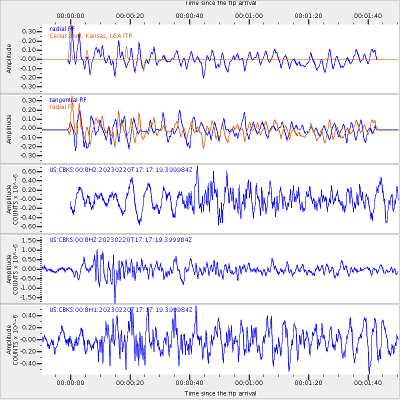
CBKS Cedar Bluff, Kansas, USA - Earthquake Result Viewer
*The percent match for this event was below the threshold and hence no stack was calculated.
| Earthquake location: |
Jordan - Syria Region |
| Earthquake latitude/longitude: |
36.1/36.0 |
| Earthquake time(UTC): |
2023/02/20 (051) 17:04:29 GMT |
| Earthquake Depth: |
16 km |
| Earthquake Magnitude: |
6.3 Mww |
| Earthquake Catalog/Contributor: |
NEIC PDE/us |
|
| Network: |
US United States National Seismic Network |
| Station: |
CBKS Cedar Bluff, Kansas, USA |
| Lat/Lon: |
38.81 N/99.74 W |
| Elevation: |
677 m |
|
| Distance: |
95.0 deg |
| Az: |
326.827 deg |
| Baz: |
34.552 deg |
| Ray Param: |
$rayparam |
*The percent match for this event was below the threshold and hence was not used in the summary stack. |
|
| Radial Match: |
59.99844 % |
| Radial Bump: |
400 |
| Transverse Match: |
57.62531 % |
| Transverse Bump: |
400 |
| SOD ConfigId: |
29823551 |
| Insert Time: |
2023-03-06 17:25:31.459 +0000 |
| GWidth: |
2.5 |
| Max Bumps: |
400 |
| Tol: |
0.001 |
|
Signal To Noise
| Channel | StoN | STA | LTA |
| US:CBKS:00:BHZ:20230220T17:17:19.399984Z | 2.6909325 | 2.7967275E-7 | 1.0393153E-7 |
| US:CBKS:00:BH1:20230220T17:17:19.399984Z | 0.87403345 | 1.0037598E-7 | 1.14842265E-7 |
| US:CBKS:00:BH2:20230220T17:17:19.399984Z | 0.951832 | 1.9109305E-7 | 2.0076342E-7 |
| Arrivals |
| Ps | |
| PpPs | |
| PsPs/PpSs | |


