You are here: Home > Network List > US - United States National Seismic Network Stations List
> Station MSO Missoula, Montana, USA > Earthquake Result Viewer
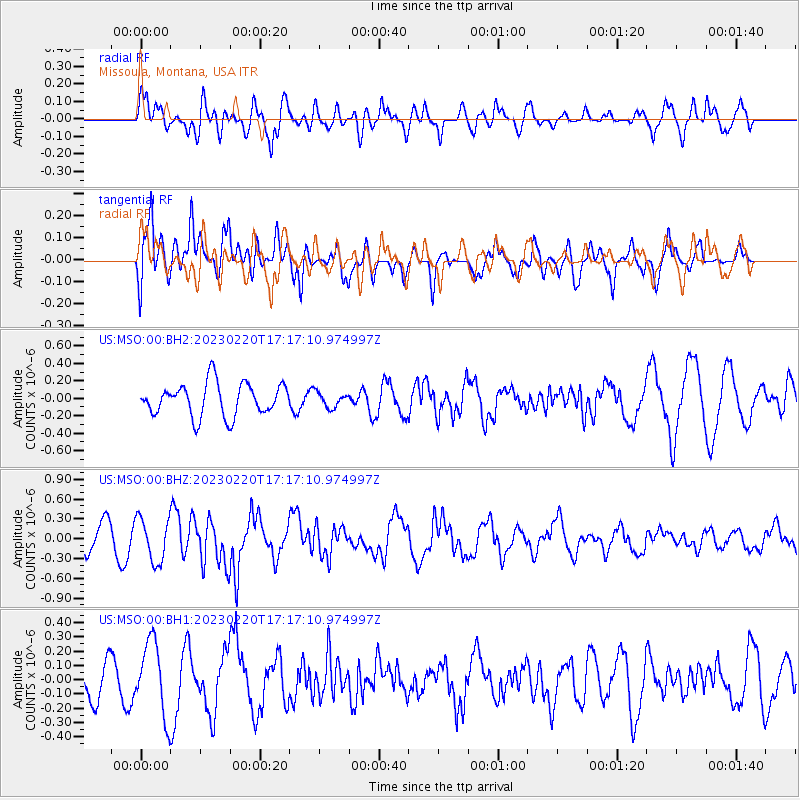
MSO Missoula, Montana, USA - Earthquake Result Viewer
*The percent match for this event was below the threshold and hence no stack was calculated.
| Earthquake location: |
Jordan - Syria Region |
| Earthquake latitude/longitude: |
36.1/36.0 |
| Earthquake time(UTC): |
2023/02/20 (051) 17:04:29 GMT |
| Earthquake Depth: |
16 km |
| Earthquake Magnitude: |
6.3 Mww |
| Earthquake Catalog/Contributor: |
NEIC PDE/us |
|
| Network: |
US United States National Seismic Network |
| Station: |
MSO Missoula, Montana, USA |
| Lat/Lon: |
46.83 N/113.94 W |
| Elevation: |
1264 m |
|
| Distance: |
93.1 deg |
| Az: |
339.863 deg |
| Baz: |
23.955 deg |
| Ray Param: |
$rayparam |
*The percent match for this event was below the threshold and hence was not used in the summary stack. |
|
| Radial Match: |
59.17582 % |
| Radial Bump: |
400 |
| Transverse Match: |
72.36207 % |
| Transverse Bump: |
400 |
| SOD ConfigId: |
29823551 |
| Insert Time: |
2023-03-06 17:25:55.081 +0000 |
| GWidth: |
2.5 |
| Max Bumps: |
400 |
| Tol: |
0.001 |
|
Signal To Noise
| Channel | StoN | STA | LTA |
| US:MSO:00:BHZ:20230220T17:17:10.974997Z | 2.2692218 | 3.306776E-7 | 1.4572291E-7 |
| US:MSO:00:BH1:20230220T17:17:10.974997Z | 2.087957 | 2.6017904E-7 | 1.246094E-7 |
| US:MSO:00:BH2:20230220T17:17:10.974997Z | 0.45517007 | 8.5263224E-8 | 1.8732167E-7 |
| Arrivals |
| Ps | |
| PpPs | |
| PsPs/PpSs | |


