You are here: Home > Network List > AV - Alaska Volcano Observatory Stations List
> Station AMKA Regional Station, Amchitka Island, Alaska > Earthquake Result Viewer
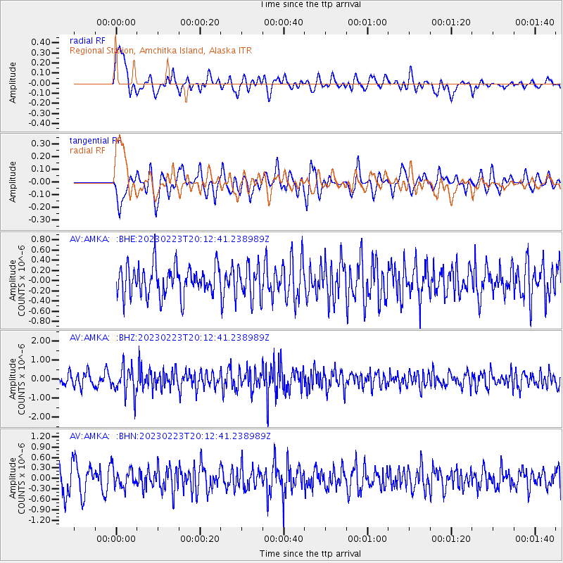
AMKA Regional Station, Amchitka Island, Alaska - Earthquake Result Viewer
*The percent match for this event was below the threshold and hence no stack was calculated.
| Earthquake location: |
North Of Halmahera, Indonesia |
| Earthquake latitude/longitude: |
3.3/128.1 |
| Earthquake time(UTC): |
2023/02/23 (054) 20:02:48 GMT |
| Earthquake Depth: |
97 km |
| Earthquake Magnitude: |
6.3 mww |
| Earthquake Catalog/Contributor: |
NEIC PDE/us |
|
| Network: |
AV Alaska Volcano Observatory |
| Station: |
AMKA Regional Station, Amchitka Island, Alaska |
| Lat/Lon: |
51.38 N/179.30 E |
| Elevation: |
116 m |
|
| Distance: |
64.1 deg |
| Az: |
32.872 deg |
| Baz: |
239.836 deg |
| Ray Param: |
$rayparam |
*The percent match for this event was below the threshold and hence was not used in the summary stack. |
|
| Radial Match: |
52.89383 % |
| Radial Bump: |
400 |
| Transverse Match: |
43.705322 % |
| Transverse Bump: |
400 |
| SOD ConfigId: |
29823551 |
| Insert Time: |
2023-03-09 20:08:24.123 +0000 |
| GWidth: |
2.5 |
| Max Bumps: |
400 |
| Tol: |
0.001 |
|
Signal To Noise
| Channel | StoN | STA | LTA |
| AV:AMKA: :BHZ:20230223T20:12:41.238989Z | 2.1874835 | 7.3603945E-7 | 3.3647774E-7 |
| AV:AMKA: :BHN:20230223T20:12:41.238989Z | 0.5933615 | 2.4617322E-7 | 4.14879E-7 |
| AV:AMKA: :BHE:20230223T20:12:41.238989Z | 1.1362103 | 3.2620403E-7 | 2.870983E-7 |
| Arrivals |
| Ps | |
| PpPs | |
| PsPs/PpSs | |


