You are here: Home > Network List > GS - US Geological Survey Networks Stations List
> Station OK051 E0350 and S34600 roads, Ralston OK > Earthquake Result Viewer
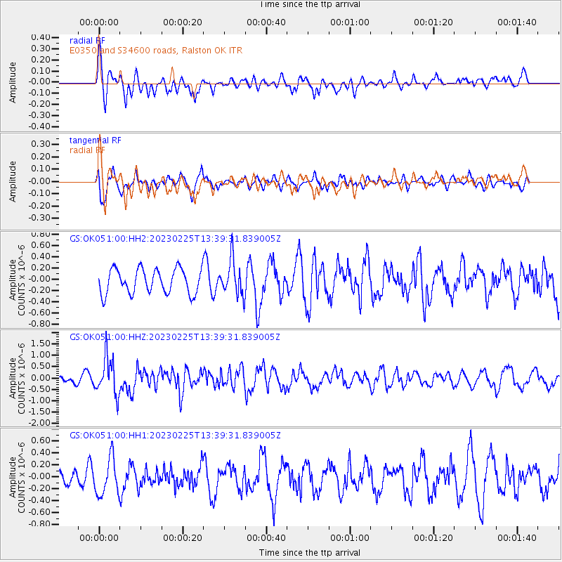
OK051 E0350 and S34600 roads, Ralston OK - Earthquake Result Viewer
*The percent match for this event was below the threshold and hence no stack was calculated.
| Earthquake location: |
Hokkaido, Japan Region |
| Earthquake latitude/longitude: |
42.8/145.1 |
| Earthquake time(UTC): |
2023/02/25 (056) 13:27:42 GMT |
| Earthquake Depth: |
43 km |
| Earthquake Magnitude: |
6.1 Mww |
| Earthquake Catalog/Contributor: |
NEIC PDE/us |
|
| Network: |
GS US Geological Survey Networks |
| Station: |
OK051 E0350 and S34600 roads, Ralston OK |
| Lat/Lon: |
36.50 N/96.84 W |
| Elevation: |
263 m |
|
| Distance: |
83.0 deg |
| Az: |
45.769 deg |
| Baz: |
319.076 deg |
| Ray Param: |
$rayparam |
*The percent match for this event was below the threshold and hence was not used in the summary stack. |
|
| Radial Match: |
53.773987 % |
| Radial Bump: |
395 |
| Transverse Match: |
51.5764 % |
| Transverse Bump: |
400 |
| SOD ConfigId: |
29823551 |
| Insert Time: |
2023-03-11 13:46:32.614 +0000 |
| GWidth: |
2.5 |
| Max Bumps: |
400 |
| Tol: |
0.001 |
|
Signal To Noise
| Channel | StoN | STA | LTA |
| GS:OK051:00:HHZ:20230225T13:39:31.839005Z | 6.084284 | 8.301129E-7 | 1.364356E-7 |
| GS:OK051:00:HH1:20230225T13:39:31.839005Z | 1.6642071 | 3.1455903E-7 | 1.8901436E-7 |
| GS:OK051:00:HH2:20230225T13:39:31.839005Z | 1.4618762 | 3.1847958E-7 | 2.1785675E-7 |
| Arrivals |
| Ps | |
| PpPs | |
| PsPs/PpSs | |


