You are here: Home > Network List > US - United States National Seismic Network Stations List
> Station BOZ Bozeman, Montana, USA > Earthquake Result Viewer
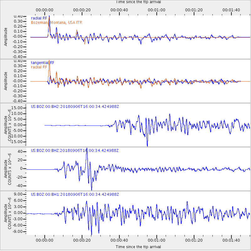
BOZ Bozeman, Montana, USA - Earthquake Result Viewer
*The percent match for this event was below the threshold and hence no stack was calculated.
| Earthquake location: |
Fiji Islands |
| Earthquake latitude/longitude: |
-18.4/179.5 |
| Earthquake time(UTC): |
2018/09/06 (249) 15:49:17 GMT |
| Earthquake Depth: |
669 km |
| Earthquake Magnitude: |
8.1 Mi |
| Earthquake Catalog/Contributor: |
NEIC PDE/at |
|
| Network: |
US United States National Seismic Network |
| Station: |
BOZ Bozeman, Montana, USA |
| Lat/Lon: |
45.65 N/111.63 W |
| Elevation: |
1589 m |
|
| Distance: |
89.1 deg |
| Az: |
40.874 deg |
| Baz: |
242.349 deg |
| Ray Param: |
$rayparam |
*The percent match for this event was below the threshold and hence was not used in the summary stack. |
|
| Radial Match: |
97.46685 % |
| Radial Bump: |
400 |
| Transverse Match: |
95.40925 % |
| Transverse Bump: |
400 |
| SOD ConfigId: |
3045211 |
| Insert Time: |
2018-10-09 20:45:41.200 +0000 |
| GWidth: |
2.5 |
| Max Bumps: |
400 |
| Tol: |
0.001 |
|
Signal To Noise
| Channel | StoN | STA | LTA |
| US:BOZ:00:BHZ:20180906T16:00:34.424988Z | 3.1279185 | 4.0260352E-7 | 1.2871291E-7 |
| US:BOZ:00:BH1:20180906T16:00:34.424988Z | 1.2122785 | 1.15745884E-7 | 9.5477965E-8 |
| US:BOZ:00:BH2:20180906T16:00:34.424988Z | 1.8856902 | 1.8584537E-7 | 9.855562E-8 |
| Arrivals |
| Ps | |
| PpPs | |
| PsPs/PpSs | |


