You are here: Home > Network List > US - United States National Seismic Network Stations List
> Station LAO LASA Array, Montana, USA > Earthquake Result Viewer
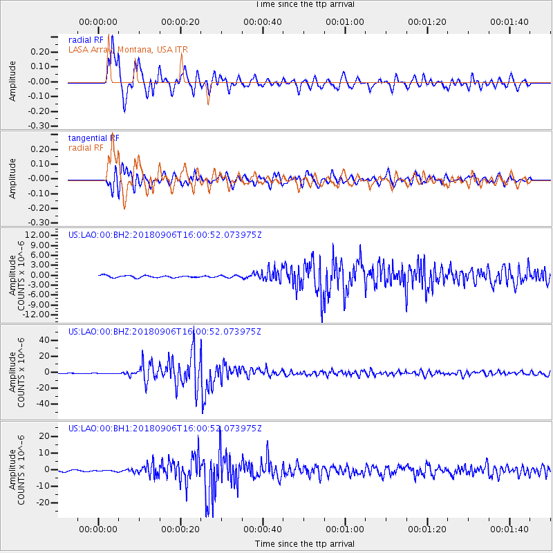
LAO LASA Array, Montana, USA - Earthquake Result Viewer
*The percent match for this event was below the threshold and hence no stack was calculated.
| Earthquake location: |
Fiji Islands |
| Earthquake latitude/longitude: |
-18.4/179.5 |
| Earthquake time(UTC): |
2018/09/06 (249) 15:49:17 GMT |
| Earthquake Depth: |
669 km |
| Earthquake Magnitude: |
8.1 Mi |
| Earthquake Catalog/Contributor: |
NEIC PDE/at |
|
| Network: |
US United States National Seismic Network |
| Station: |
LAO LASA Array, Montana, USA |
| Lat/Lon: |
46.69 N/106.22 W |
| Elevation: |
902 m |
|
| Distance: |
92.9 deg |
| Az: |
41.566 deg |
| Baz: |
246.226 deg |
| Ray Param: |
$rayparam |
*The percent match for this event was below the threshold and hence was not used in the summary stack. |
|
| Radial Match: |
97.36188 % |
| Radial Bump: |
400 |
| Transverse Match: |
94.99617 % |
| Transverse Bump: |
400 |
| SOD ConfigId: |
3045211 |
| Insert Time: |
2018-10-09 20:45:51.660 +0000 |
| GWidth: |
2.5 |
| Max Bumps: |
400 |
| Tol: |
0.001 |
|
Signal To Noise
| Channel | StoN | STA | LTA |
| US:LAO:00:BHZ:20180906T16:00:52.073975Z | 2.5817828 | 4.35605E-7 | 1.6872255E-7 |
| US:LAO:00:BH1:20180906T16:00:52.073975Z | 0.94517446 | 3.9007074E-7 | 4.126971E-7 |
| US:LAO:00:BH2:20180906T16:00:52.073975Z | 0.83399206 | 2.7328727E-7 | 3.2768568E-7 |
| Arrivals |
| Ps | |
| PpPs | |
| PsPs/PpSs | |


