You are here: Home > Network List > WY - Yellowstone Wyoming Seismic Network Stations List
> Station YHH Holmes Hill, YNP, WY, USA > Earthquake Result Viewer
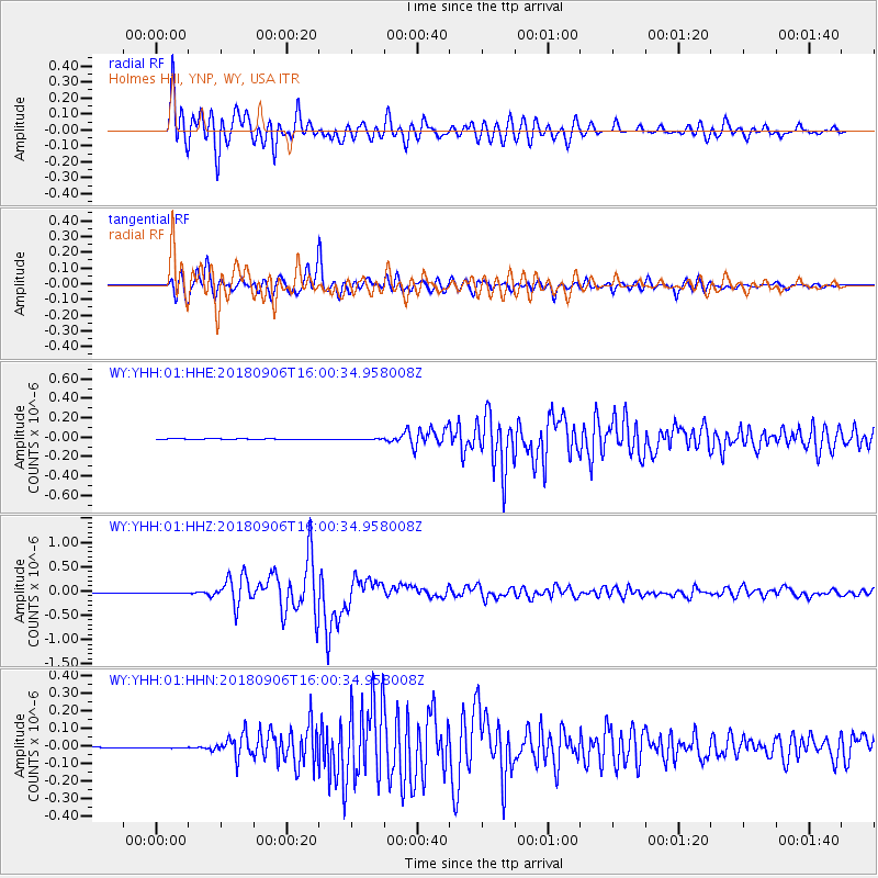
YHH Holmes Hill, YNP, WY, USA - Earthquake Result Viewer
*The percent match for this event was below the threshold and hence no stack was calculated.
| Earthquake location: |
Fiji Islands |
| Earthquake latitude/longitude: |
-18.4/179.5 |
| Earthquake time(UTC): |
2018/09/06 (249) 15:49:17 GMT |
| Earthquake Depth: |
669 km |
| Earthquake Magnitude: |
8.1 Mi |
| Earthquake Catalog/Contributor: |
NEIC PDE/at |
|
| Network: |
WY Yellowstone Wyoming Seismic Network |
| Station: |
YHH Holmes Hill, YNP, WY, USA |
| Lat/Lon: |
44.79 N/110.85 W |
| Elevation: |
2717 m |
|
| Distance: |
89.1 deg |
| Az: |
41.89 deg |
| Baz: |
242.916 deg |
| Ray Param: |
$rayparam |
*The percent match for this event was below the threshold and hence was not used in the summary stack. |
|
| Radial Match: |
96.10693 % |
| Radial Bump: |
400 |
| Transverse Match: |
93.73206 % |
| Transverse Bump: |
400 |
| SOD ConfigId: |
3045211 |
| Insert Time: |
2018-10-09 20:46:57.849 +0000 |
| GWidth: |
2.5 |
| Max Bumps: |
400 |
| Tol: |
0.001 |
|
Signal To Noise
| Channel | StoN | STA | LTA |
| WY:YHH:01:HHZ:20180906T16:00:34.958008Z | 3.2834394 | 1.1596111E-8 | 3.5316965E-9 |
| WY:YHH:01:HHN:20180906T16:00:34.958008Z | 1.7547647 | 3.1933973E-9 | 1.8198437E-9 |
| WY:YHH:01:HHE:20180906T16:00:34.958008Z | 1.52146 | 4.2067145E-9 | 2.7649196E-9 |
| Arrivals |
| Ps | |
| PpPs | |
| PsPs/PpSs | |


