You are here: Home > Network List > G - GEOSCOPE Stations List
> Station INU Inuyama, Japan > Earthquake Result Viewer
INU Inuyama, Japan - Earthquake Result Viewer
*The percent match for this event was below the threshold and hence no stack was calculated.
| Earthquake location: |
Fiji Islands Region |
| Earthquake latitude/longitude: |
-20.5/-178.4 |
| Earthquake time(UTC): |
2023/02/27 (058) 06:40:59 GMT |
| Earthquake Depth: |
548 km |
| Earthquake Magnitude: |
5.6 Mww |
| Earthquake Catalog/Contributor: |
NEIC PDE/us |
|
| Network: |
G GEOSCOPE |
| Station: |
INU Inuyama, Japan |
| Lat/Lon: |
35.35 N/137.03 E |
| Elevation: |
132 m |
|
| Distance: |
69.8 deg |
| Az: |
322.3 deg |
| Baz: |
135.482 deg |
| Ray Param: |
$rayparam |
*The percent match for this event was below the threshold and hence was not used in the summary stack. |
|
| Radial Match: |
56.209305 % |
| Radial Bump: |
370 |
| Transverse Match: |
49.603027 % |
| Transverse Bump: |
400 |
| SOD ConfigId: |
29823551 |
| Insert Time: |
2023-03-13 06:53:12.563 +0000 |
| GWidth: |
2.5 |
| Max Bumps: |
400 |
| Tol: |
0.001 |
|
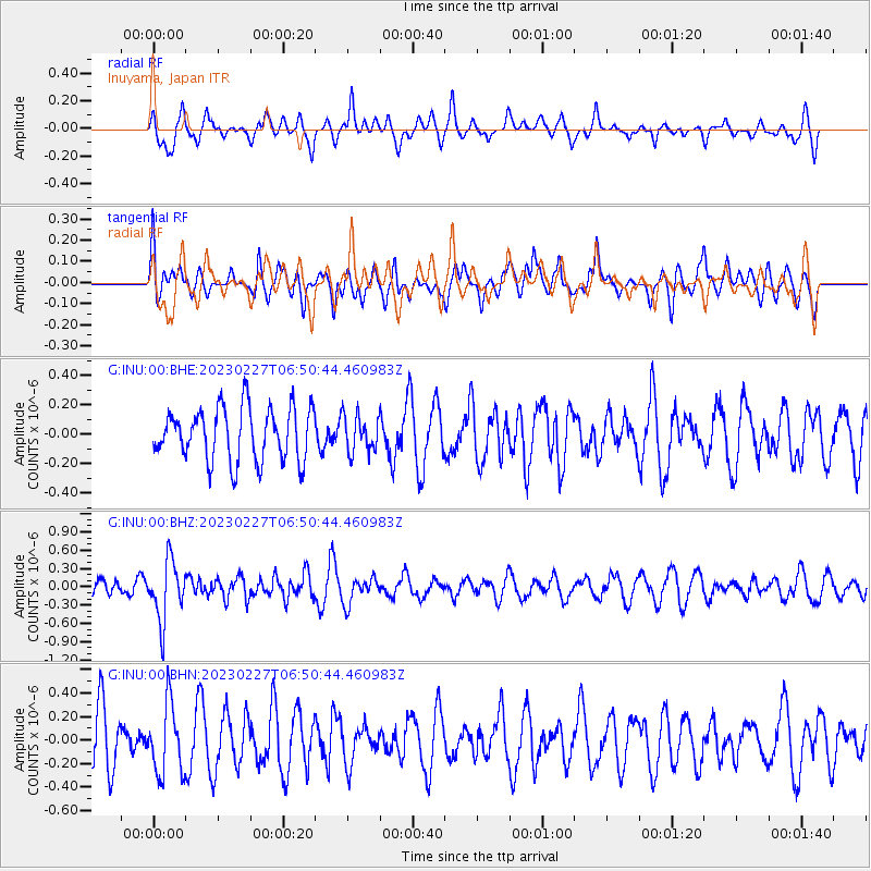
Signal To Noise
| Channel | StoN | STA | LTA |
| G:INU:00:BHZ:20230227T06:50:44.460983Z | 3.112616 | 4.891338E-7 | 1.5714556E-7 |
| G:INU:00:BHN:20230227T06:50:44.460983Z | 1.478178 | 2.9768648E-7 | 2.0138744E-7 |
| G:INU:00:BHE:20230227T06:50:44.460983Z | 0.68940556 | 1.239979E-7 | 1.7986206E-7 |
| Arrivals |
| Ps | |
| PpPs | |
| PsPs/PpSs | |


