You are here: Home > Network List > GS - US Geological Survey Networks Stations List
> Station OK051 E0350 and S34600 roads, Ralston OK > Earthquake Result Viewer
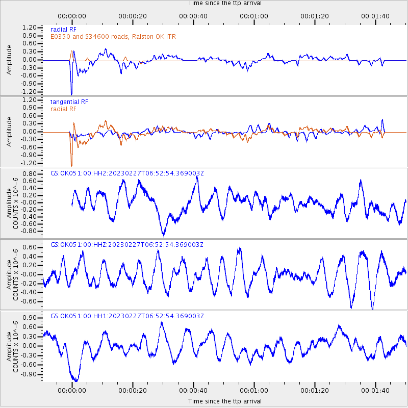
OK051 E0350 and S34600 roads, Ralston OK - Earthquake Result Viewer
*The percent match for this event was below the threshold and hence no stack was calculated.
| Earthquake location: |
Fiji Islands Region |
| Earthquake latitude/longitude: |
-20.5/-178.4 |
| Earthquake time(UTC): |
2023/02/27 (058) 06:40:59 GMT |
| Earthquake Depth: |
548 km |
| Earthquake Magnitude: |
5.6 Mww |
| Earthquake Catalog/Contributor: |
NEIC PDE/us |
|
| Network: |
GS US Geological Survey Networks |
| Station: |
OK051 E0350 and S34600 roads, Ralston OK |
| Lat/Lon: |
36.50 N/96.84 W |
| Elevation: |
263 m |
|
| Distance: |
95.5 deg |
| Az: |
53.183 deg |
| Baz: |
248.631 deg |
| Ray Param: |
$rayparam |
*The percent match for this event was below the threshold and hence was not used in the summary stack. |
|
| Radial Match: |
42.282757 % |
| Radial Bump: |
400 |
| Transverse Match: |
49.299248 % |
| Transverse Bump: |
400 |
| SOD ConfigId: |
29823551 |
| Insert Time: |
2023-03-13 06:53:46.904 +0000 |
| GWidth: |
2.5 |
| Max Bumps: |
400 |
| Tol: |
0.001 |
|
Signal To Noise
| Channel | StoN | STA | LTA |
| GS:OK051:00:HHZ:20230227T06:52:54.369003Z | 1.340851 | 2.8599973E-7 | 2.132972E-7 |
| GS:OK051:00:HH1:20230227T06:52:54.369003Z | 3.3341262 | 9.006102E-7 | 2.7011882E-7 |
| GS:OK051:00:HH2:20230227T06:52:54.369003Z | 2.550315 | 7.170566E-7 | 2.8116392E-7 |
| Arrivals |
| Ps | |
| PpPs | |
| PsPs/PpSs | |


