You are here: Home > Network List > US - United States National Seismic Network Stations List
> Station MNTX Cornudas Mountains, Texas, USA > Earthquake Result Viewer
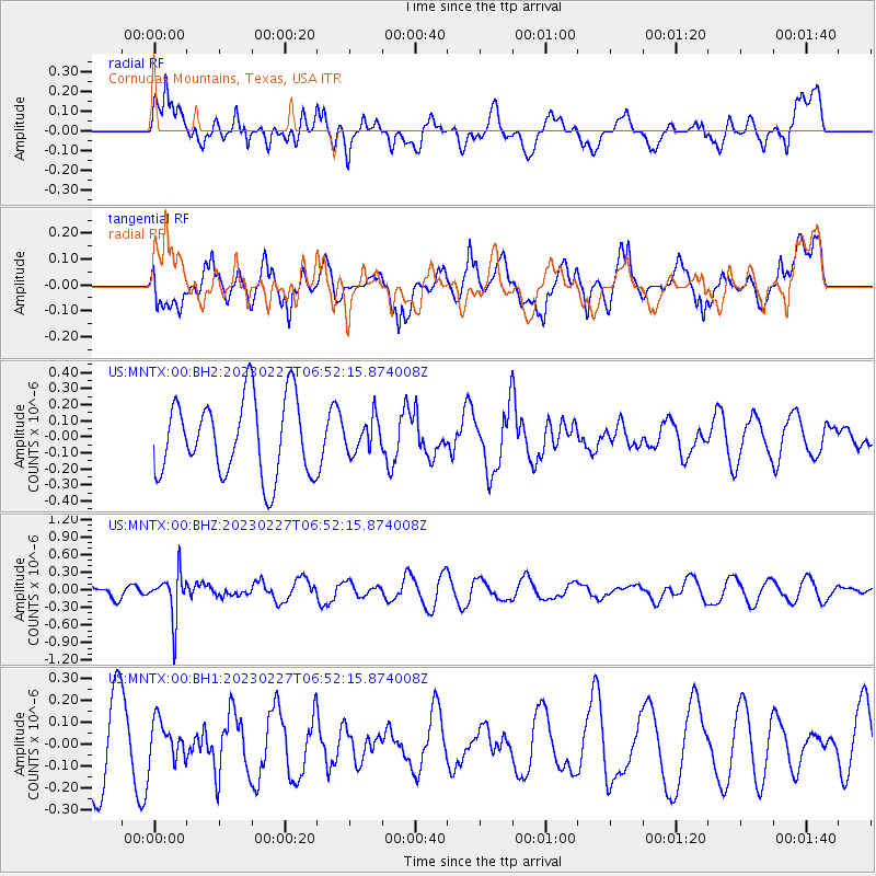
MNTX Cornudas Mountains, Texas, USA - Earthquake Result Viewer
*The percent match for this event was below the threshold and hence no stack was calculated.
| Earthquake location: |
Fiji Islands Region |
| Earthquake latitude/longitude: |
-20.5/-178.4 |
| Earthquake time(UTC): |
2023/02/27 (058) 06:40:59 GMT |
| Earthquake Depth: |
548 km |
| Earthquake Magnitude: |
5.6 Mww |
| Earthquake Catalog/Contributor: |
NEIC PDE/us |
|
| Network: |
US United States National Seismic Network |
| Station: |
MNTX Cornudas Mountains, Texas, USA |
| Lat/Lon: |
31.70 N/105.38 W |
| Elevation: |
405 m |
|
| Distance: |
87.0 deg |
| Az: |
54.701 deg |
| Baz: |
243.818 deg |
| Ray Param: |
$rayparam |
*The percent match for this event was below the threshold and hence was not used in the summary stack. |
|
| Radial Match: |
48.48446 % |
| Radial Bump: |
400 |
| Transverse Match: |
42.23896 % |
| Transverse Bump: |
400 |
| SOD ConfigId: |
29823551 |
| Insert Time: |
2023-03-13 07:02:21.058 +0000 |
| GWidth: |
2.5 |
| Max Bumps: |
400 |
| Tol: |
0.001 |
|
Signal To Noise
| Channel | StoN | STA | LTA |
| US:MNTX:00:BHZ:20230227T06:52:15.874008Z | 2.742951 | 3.803749E-7 | 1.386736E-7 |
| US:MNTX:00:BH1:20230227T06:52:15.874008Z | 0.41605482 | 8.982979E-8 | 2.1590854E-7 |
| US:MNTX:00:BH2:20230227T06:52:15.874008Z | 0.43414903 | 1.0357509E-7 | 2.3857035E-7 |
| Arrivals |
| Ps | |
| PpPs | |
| PsPs/PpSs | |


