You are here: Home > Network List > US - United States National Seismic Network Stations List
> Station NEW Newport, Washington, USA > Earthquake Result Viewer
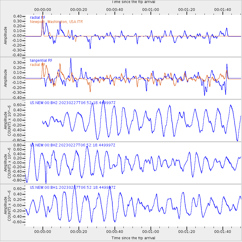
NEW Newport, Washington, USA - Earthquake Result Viewer
*The percent match for this event was below the threshold and hence no stack was calculated.
| Earthquake location: |
Fiji Islands Region |
| Earthquake latitude/longitude: |
-20.5/-178.4 |
| Earthquake time(UTC): |
2023/02/27 (058) 06:40:59 GMT |
| Earthquake Depth: |
548 km |
| Earthquake Magnitude: |
5.6 Mww |
| Earthquake Catalog/Contributor: |
NEIC PDE/us |
|
| Network: |
US United States National Seismic Network |
| Station: |
NEW Newport, Washington, USA |
| Lat/Lon: |
48.26 N/117.12 W |
| Elevation: |
760 m |
|
| Distance: |
87.6 deg |
| Az: |
35.895 deg |
| Baz: |
235.324 deg |
| Ray Param: |
$rayparam |
*The percent match for this event was below the threshold and hence was not used in the summary stack. |
|
| Radial Match: |
59.182907 % |
| Radial Bump: |
400 |
| Transverse Match: |
75.28589 % |
| Transverse Bump: |
400 |
| SOD ConfigId: |
29823551 |
| Insert Time: |
2023-03-13 07:02:24.533 +0000 |
| GWidth: |
2.5 |
| Max Bumps: |
400 |
| Tol: |
0.001 |
|
Signal To Noise
| Channel | StoN | STA | LTA |
| US:NEW:00:BHZ:20230227T06:52:18.449997Z | 0.9716503 | 3.569258E-7 | 3.6733977E-7 |
| US:NEW:00:BH1:20230227T06:52:18.449997Z | 0.7034865 | 2.3526549E-7 | 3.3442785E-7 |
| US:NEW:00:BH2:20230227T06:52:18.449997Z | 2.6765542 | 5.5721017E-7 | 2.081819E-7 |
| Arrivals |
| Ps | |
| PpPs | |
| PsPs/PpSs | |


