You are here: Home > Network List > UW - Pacific Northwest Regional Seismic Network Stations List
> Station UMAT Pilot Rock, OR, USA > Earthquake Result Viewer
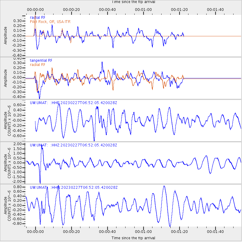
UMAT Pilot Rock, OR, USA - Earthquake Result Viewer
*The percent match for this event was below the threshold and hence no stack was calculated.
| Earthquake location: |
Fiji Islands Region |
| Earthquake latitude/longitude: |
-20.5/-178.4 |
| Earthquake time(UTC): |
2023/02/27 (058) 06:40:59 GMT |
| Earthquake Depth: |
548 km |
| Earthquake Magnitude: |
5.6 Mww |
| Earthquake Catalog/Contributor: |
NEIC PDE/us |
|
| Network: |
UW Pacific Northwest Regional Seismic Network |
| Station: |
UMAT Pilot Rock, OR, USA |
| Lat/Lon: |
45.29 N/118.96 W |
| Elevation: |
1318 m |
|
| Distance: |
84.8 deg |
| Az: |
37.595 deg |
| Baz: |
234.099 deg |
| Ray Param: |
$rayparam |
*The percent match for this event was below the threshold and hence was not used in the summary stack. |
|
| Radial Match: |
60.472267 % |
| Radial Bump: |
328 |
| Transverse Match: |
52.57607 % |
| Transverse Bump: |
400 |
| SOD ConfigId: |
29823551 |
| Insert Time: |
2023-03-13 07:04:45.347 +0000 |
| GWidth: |
2.5 |
| Max Bumps: |
400 |
| Tol: |
0.001 |
|
Signal To Noise
| Channel | StoN | STA | LTA |
| UW:UMAT: :HHZ:20230227T06:52:05.420028Z | 3.889676 | 9.242623E-7 | 2.3761936E-7 |
| UW:UMAT: :HHN:20230227T06:52:05.420028Z | 0.9748658 | 2.8915468E-7 | 2.9660973E-7 |
| UW:UMAT: :HHE:20230227T06:52:05.420028Z | 1.1553793 | 3.7059698E-7 | 3.2075783E-7 |
| Arrivals |
| Ps | |
| PpPs | |
| PsPs/PpSs | |


