You are here: Home > Network List > C8 - Canadian Seismic Research Network () Stations List
> Station GRIB Gribbell Island, BC, CA > Earthquake Result Viewer
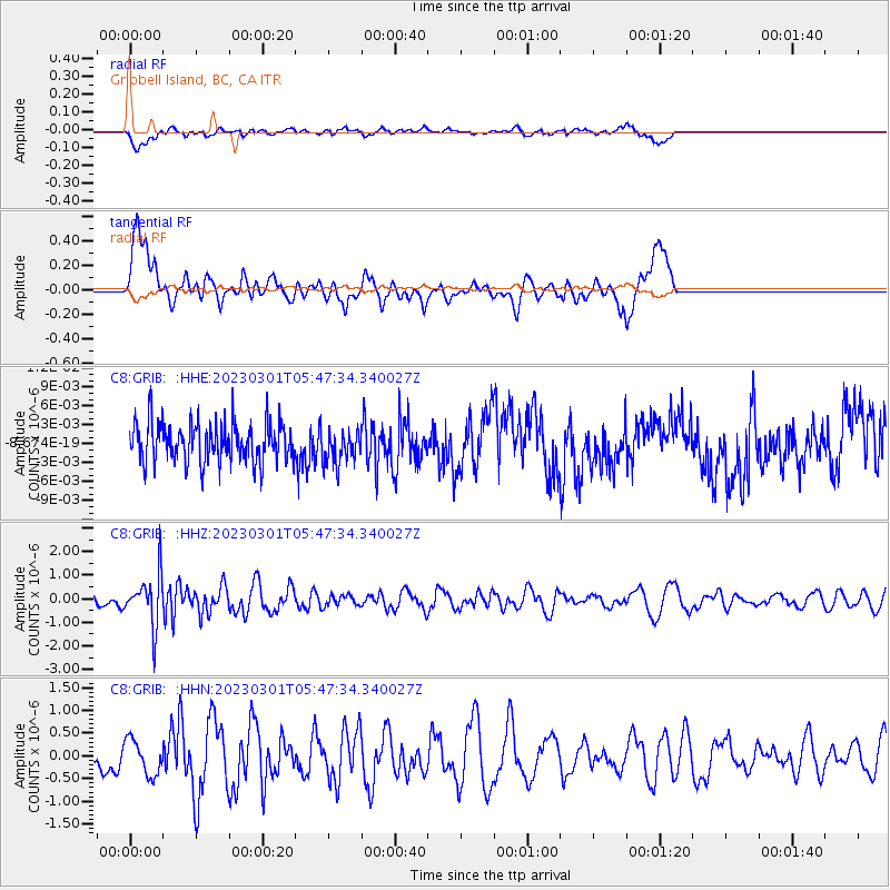
GRIB Gribbell Island, BC, CA - Earthquake Result Viewer
*The percent match for this event was below the threshold and hence no stack was calculated.
| Earthquake location: |
Bismarck Sea |
| Earthquake latitude/longitude: |
-4.8/149.6 |
| Earthquake time(UTC): |
2023/03/01 (060) 05:36:14 GMT |
| Earthquake Depth: |
583 km |
| Earthquake Magnitude: |
6.5 Mi |
| Earthquake Catalog/Contributor: |
NEIC PDE/at |
|
| Network: |
C8 Canadian Seismic Research Network () |
| Station: |
GRIB Gribbell Island, BC, CA |
| Lat/Lon: |
53.34 N/129.14 W |
| Elevation: |
418 m |
|
| Distance: |
88.6 deg |
| Az: |
36.362 deg |
| Baz: |
260.151 deg |
| Ray Param: |
$rayparam |
*The percent match for this event was below the threshold and hence was not used in the summary stack. |
|
| Radial Match: |
60.056595 % |
| Radial Bump: |
400 |
| Transverse Match: |
59.95245 % |
| Transverse Bump: |
400 |
| SOD ConfigId: |
29823551 |
| Insert Time: |
2023-03-15 05:45:50.068 +0000 |
| GWidth: |
2.5 |
| Max Bumps: |
400 |
| Tol: |
0.001 |
|
Signal To Noise
| Channel | StoN | STA | LTA |
| C8:GRIB: :HHZ:20230301T05:47:34.340027Z | 2.7141252 | 1.0977578E-6 | 4.0446105E-7 |
| C8:GRIB: :HHN:20230301T05:47:34.340027Z | 0.8095635 | 3.876219E-7 | 4.7880354E-7 |
| C8:GRIB: :HHE:20230301T05:47:34.340027Z | 0.85541195 | 2.704204E-9 | 3.1612883E-9 |
| Arrivals |
| Ps | |
| PpPs | |
| PsPs/PpSs | |


