You are here: Home > Network List > US - United States National Seismic Network Stations List
> Station WMOK Wichita Mountains, Oklahoma, USA > Earthquake Result Viewer
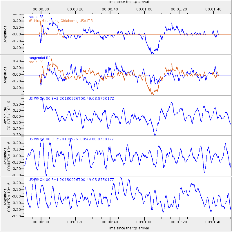
WMOK Wichita Mountains, Oklahoma, USA - Earthquake Result Viewer
*The percent match for this event was below the threshold and hence no stack was calculated.
| Earthquake location: |
Fiji Islands Region |
| Earthquake latitude/longitude: |
-18.0/-178.1 |
| Earthquake time(UTC): |
2018/09/26 (269) 00:37:33 GMT |
| Earthquake Depth: |
569 km |
| Earthquake Magnitude: |
5.8 Mwb |
| Earthquake Catalog/Contributor: |
NEIC PDE/us |
|
| Network: |
US United States National Seismic Network |
| Station: |
WMOK Wichita Mountains, Oklahoma, USA |
| Lat/Lon: |
34.74 N/98.78 W |
| Elevation: |
486 m |
|
| Distance: |
91.7 deg |
| Az: |
54.061 deg |
| Baz: |
249.308 deg |
| Ray Param: |
$rayparam |
*The percent match for this event was below the threshold and hence was not used in the summary stack. |
|
| Radial Match: |
35.168526 % |
| Radial Bump: |
400 |
| Transverse Match: |
35.16327 % |
| Transverse Bump: |
400 |
| SOD ConfigId: |
3045211 |
| Insert Time: |
2018-10-10 00:45:54.428 +0000 |
| GWidth: |
2.5 |
| Max Bumps: |
400 |
| Tol: |
0.001 |
|
Signal To Noise
| Channel | StoN | STA | LTA |
| US:WMOK:00:BHZ:20180926T00:49:08.875017Z | 2.8228939 | 1.9056746E-7 | 6.750784E-8 |
| US:WMOK:00:BH1:20180926T00:49:08.875017Z | 1.3891522 | 1.1969662E-7 | 8.616523E-8 |
| US:WMOK:00:BH2:20180926T00:49:08.875017Z | 0.82621384 | 8.510416E-8 | 1.0300501E-7 |
| Arrivals |
| Ps | |
| PpPs | |
| PsPs/PpSs | |


