You are here: Home > Network List > IU - Global Seismograph Network (GSN - IRIS/USGS) Stations List
> Station PMG Port Moresby, New Guinea > Earthquake Result Viewer
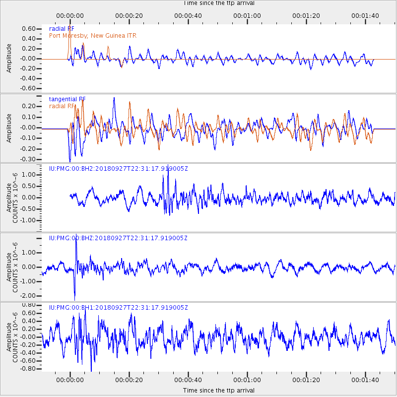
PMG Port Moresby, New Guinea - Earthquake Result Viewer
*The percent match for this event was below the threshold and hence no stack was calculated.
| Earthquake location: |
Fiji Islands Region |
| Earthquake latitude/longitude: |
-18.2/-178.2 |
| Earthquake time(UTC): |
2018/09/27 (270) 22:25:43 GMT |
| Earthquake Depth: |
540 km |
| Earthquake Magnitude: |
5.5 Mww |
| Earthquake Catalog/Contributor: |
NEIC PDE/us |
|
| Network: |
IU Global Seismograph Network (GSN - IRIS/USGS) |
| Station: |
PMG Port Moresby, New Guinea |
| Lat/Lon: |
9.40 S/147.16 E |
| Elevation: |
90 m |
|
| Distance: |
34.7 deg |
| Az: |
279.856 deg |
| Baz: |
108.316 deg |
| Ray Param: |
$rayparam |
*The percent match for this event was below the threshold and hence was not used in the summary stack. |
|
| Radial Match: |
58.194897 % |
| Radial Bump: |
400 |
| Transverse Match: |
54.933704 % |
| Transverse Bump: |
400 |
| SOD ConfigId: |
3045211 |
| Insert Time: |
2018-10-11 22:29:04.945 +0000 |
| GWidth: |
2.5 |
| Max Bumps: |
400 |
| Tol: |
0.001 |
|
Signal To Noise
| Channel | StoN | STA | LTA |
| IU:PMG:00:BHZ:20180927T22:31:17.919005Z | 2.7443616 | 7.2325867E-7 | 2.6354348E-7 |
| IU:PMG:00:BH1:20180927T22:31:17.919005Z | 1.6040448 | 2.9009266E-7 | 1.8085072E-7 |
| IU:PMG:00:BH2:20180927T22:31:17.919005Z | 1.899675 | 4.5844874E-7 | 2.413301E-7 |
| Arrivals |
| Ps | |
| PpPs | |
| PsPs/PpSs | |


