You are here: Home > Network List > US - United States National Seismic Network Stations List
> Station WMOK Wichita Mountains, Oklahoma, USA > Earthquake Result Viewer
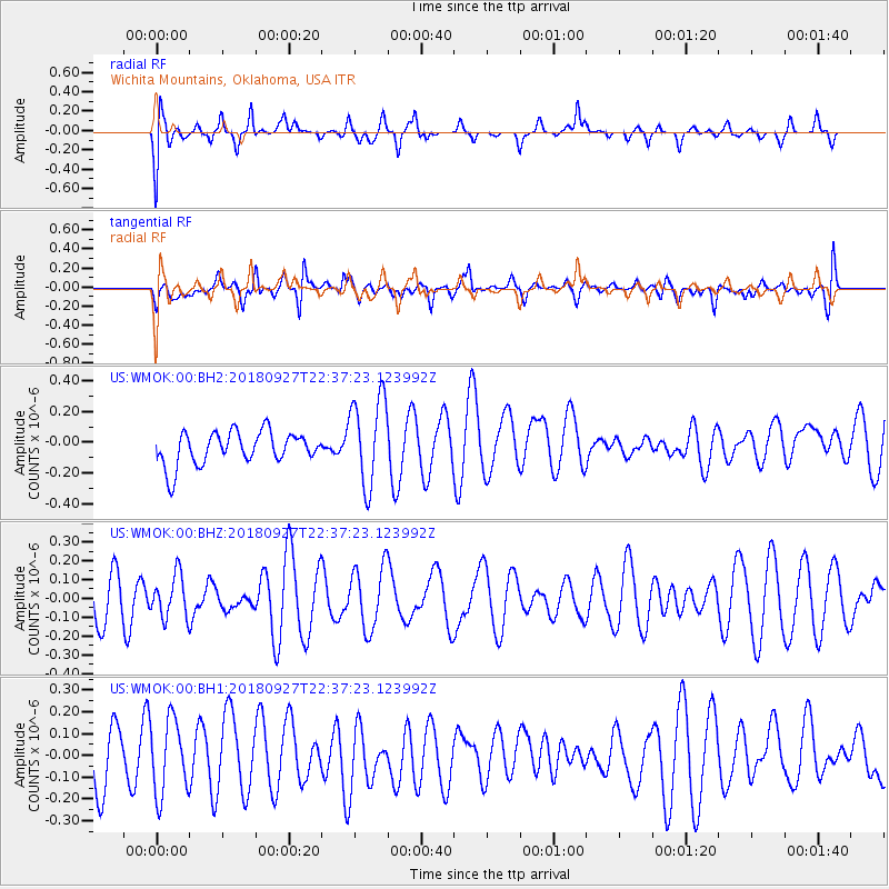
WMOK Wichita Mountains, Oklahoma, USA - Earthquake Result Viewer
*The percent match for this event was below the threshold and hence no stack was calculated.
| Earthquake location: |
Fiji Islands Region |
| Earthquake latitude/longitude: |
-18.2/-178.2 |
| Earthquake time(UTC): |
2018/09/27 (270) 22:25:43 GMT |
| Earthquake Depth: |
540 km |
| Earthquake Magnitude: |
5.5 Mww |
| Earthquake Catalog/Contributor: |
NEIC PDE/us |
|
| Network: |
US United States National Seismic Network |
| Station: |
WMOK Wichita Mountains, Oklahoma, USA |
| Lat/Lon: |
34.74 N/98.78 W |
| Elevation: |
486 m |
|
| Distance: |
91.9 deg |
| Az: |
54.105 deg |
| Baz: |
249.267 deg |
| Ray Param: |
$rayparam |
*The percent match for this event was below the threshold and hence was not used in the summary stack. |
|
| Radial Match: |
55.56123 % |
| Radial Bump: |
400 |
| Transverse Match: |
47.40302 % |
| Transverse Bump: |
400 |
| SOD ConfigId: |
3045211 |
| Insert Time: |
2018-10-11 22:30:47.662 +0000 |
| GWidth: |
2.5 |
| Max Bumps: |
400 |
| Tol: |
0.001 |
|
Signal To Noise
| Channel | StoN | STA | LTA |
| US:WMOK:00:BHZ:20180927T22:37:23.123992Z | 0.8488058 | 1.1166577E-7 | 1.3155632E-7 |
| US:WMOK:00:BH1:20180927T22:37:23.123992Z | 1.3469884 | 1.710809E-7 | 1.2700993E-7 |
| US:WMOK:00:BH2:20180927T22:37:23.123992Z | 2.7373548 | 2.8990732E-7 | 1.0590783E-7 |
| Arrivals |
| Ps | |
| PpPs | |
| PsPs/PpSs | |


