You are here: Home > Network List > US - United States National Seismic Network Stations List
> Station AMTX Amarillo, Texas, USA > Earthquake Result Viewer
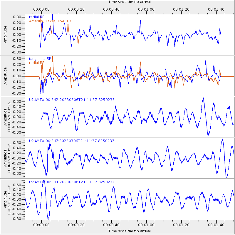
AMTX Amarillo, Texas, USA - Earthquake Result Viewer
*The percent match for this event was below the threshold and hence no stack was calculated.
| Earthquake location: |
Fiji Islands Region |
| Earthquake latitude/longitude: |
-20.8/-178.3 |
| Earthquake time(UTC): |
2023/03/06 (065) 20:59:59 GMT |
| Earthquake Depth: |
526 km |
| Earthquake Magnitude: |
5.8 mww |
| Earthquake Catalog/Contributor: |
NEIC PDE/us |
|
| Network: |
US United States National Seismic Network |
| Station: |
AMTX Amarillo, Texas, USA |
| Lat/Lon: |
34.53 N/101.41 W |
| Elevation: |
1010 m |
|
| Distance: |
91.4 deg |
| Az: |
53.544 deg |
| Baz: |
245.728 deg |
| Ray Param: |
$rayparam |
*The percent match for this event was below the threshold and hence was not used in the summary stack. |
|
| Radial Match: |
50.194946 % |
| Radial Bump: |
386 |
| Transverse Match: |
42.507473 % |
| Transverse Bump: |
373 |
| SOD ConfigId: |
30536071 |
| Insert Time: |
2023-03-20 21:23:43.051 +0000 |
| GWidth: |
2.5 |
| Max Bumps: |
400 |
| Tol: |
0.001 |
|
Signal To Noise
| Channel | StoN | STA | LTA |
| US:AMTX:00:BHZ:20230306T21:11:37.825023Z | 1.9294432 | 3.9828143E-7 | 2.0642298E-7 |
| US:AMTX:00:BH1:20230306T21:11:37.825023Z | 1.7528933 | 5.6927746E-7 | 3.2476447E-7 |
| US:AMTX:00:BH2:20230306T21:11:37.825023Z | 0.49066797 | 1.0552573E-7 | 2.1506546E-7 |
| Arrivals |
| Ps | |
| PpPs | |
| PsPs/PpSs | |


