You are here: Home > Network List > US - United States National Seismic Network Stations List
> Station HAWA Hanford, Washington, USA > Earthquake Result Viewer
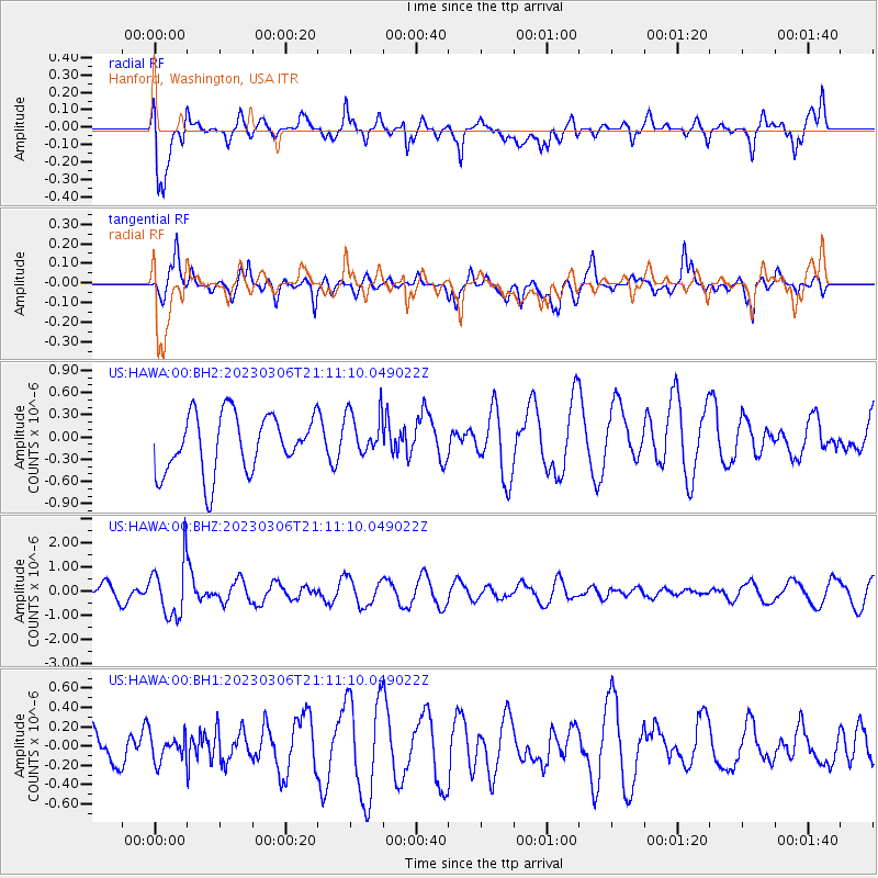
HAWA Hanford, Washington, USA - Earthquake Result Viewer
*The percent match for this event was below the threshold and hence no stack was calculated.
| Earthquake location: |
Fiji Islands Region |
| Earthquake latitude/longitude: |
-20.8/-178.3 |
| Earthquake time(UTC): |
2023/03/06 (065) 20:59:59 GMT |
| Earthquake Depth: |
526 km |
| Earthquake Magnitude: |
5.8 mww |
| Earthquake Catalog/Contributor: |
NEIC PDE/us |
|
| Network: |
US United States National Seismic Network |
| Station: |
HAWA Hanford, Washington, USA |
| Lat/Lon: |
46.39 N/119.53 W |
| Elevation: |
364 m |
|
| Distance: |
85.3 deg |
| Az: |
36.426 deg |
| Baz: |
233.395 deg |
| Ray Param: |
$rayparam |
*The percent match for this event was below the threshold and hence was not used in the summary stack. |
|
| Radial Match: |
71.34024 % |
| Radial Bump: |
400 |
| Transverse Match: |
70.942955 % |
| Transverse Bump: |
400 |
| SOD ConfigId: |
30536071 |
| Insert Time: |
2023-03-20 21:23:52.503 +0000 |
| GWidth: |
2.5 |
| Max Bumps: |
400 |
| Tol: |
0.001 |
|
Signal To Noise
| Channel | StoN | STA | LTA |
| US:HAWA:00:BHZ:20230306T21:11:10.049022Z | 3.221257 | 1.1465113E-6 | 3.5592043E-7 |
| US:HAWA:00:BH1:20230306T21:11:10.049022Z | 0.49197483 | 1.3322455E-7 | 2.7079545E-7 |
| US:HAWA:00:BH2:20230306T21:11:10.049022Z | 0.80672556 | 3.145476E-7 | 3.8990657E-7 |
| Arrivals |
| Ps | |
| PpPs | |
| PsPs/PpSs | |


