You are here: Home > Network List > US - United States National Seismic Network Stations List
> Station MSO Missoula, Montana, USA > Earthquake Result Viewer
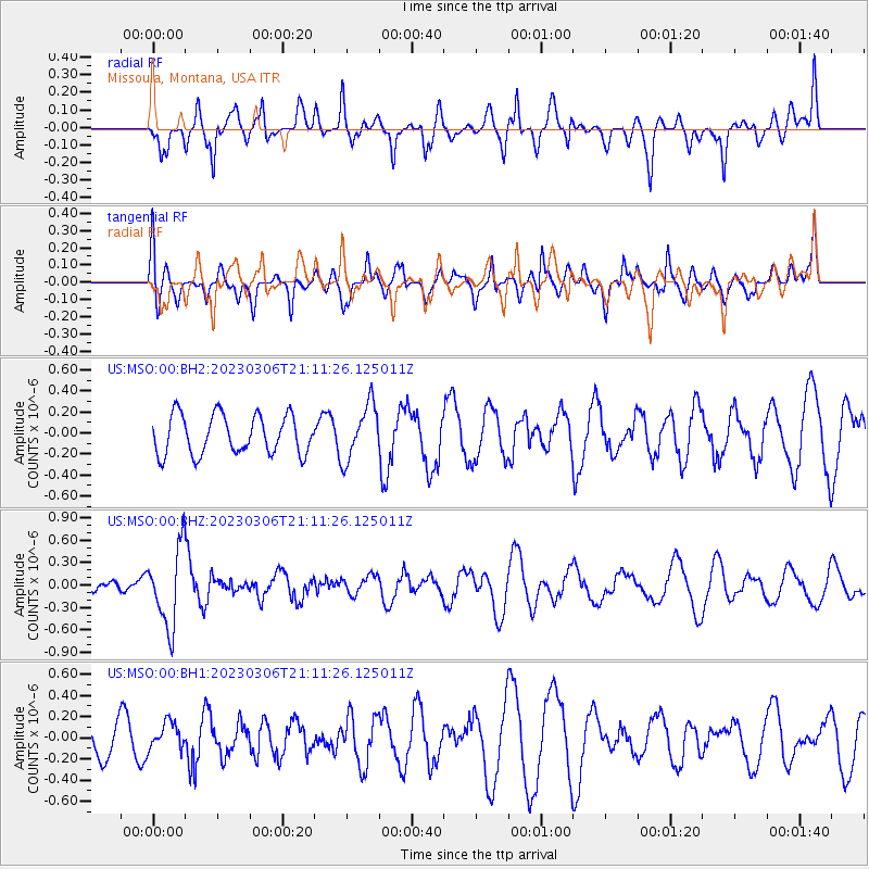
MSO Missoula, Montana, USA - Earthquake Result Viewer
*The percent match for this event was below the threshold and hence no stack was calculated.
| Earthquake location: |
Fiji Islands Region |
| Earthquake latitude/longitude: |
-20.8/-178.3 |
| Earthquake time(UTC): |
2023/03/06 (065) 20:59:59 GMT |
| Earthquake Depth: |
526 km |
| Earthquake Magnitude: |
5.8 mww |
| Earthquake Catalog/Contributor: |
NEIC PDE/us |
|
| Network: |
US United States National Seismic Network |
| Station: |
MSO Missoula, Montana, USA |
| Lat/Lon: |
46.83 N/113.94 W |
| Elevation: |
1264 m |
|
| Distance: |
88.8 deg |
| Az: |
38.254 deg |
| Baz: |
237.541 deg |
| Ray Param: |
$rayparam |
*The percent match for this event was below the threshold and hence was not used in the summary stack. |
|
| Radial Match: |
50.337757 % |
| Radial Bump: |
374 |
| Transverse Match: |
41.356976 % |
| Transverse Bump: |
400 |
| SOD ConfigId: |
30536071 |
| Insert Time: |
2023-03-20 21:23:58.545 +0000 |
| GWidth: |
2.5 |
| Max Bumps: |
400 |
| Tol: |
0.001 |
|
Signal To Noise
| Channel | StoN | STA | LTA |
| US:MSO:00:BHZ:20230306T21:11:26.125011Z | 3.317727 | 5.2882854E-7 | 1.5939483E-7 |
| US:MSO:00:BH1:20230306T21:11:26.125011Z | 0.58304274 | 1.2564675E-7 | 2.1550179E-7 |
| US:MSO:00:BH2:20230306T21:11:26.125011Z | 1.4302543 | 2.6456502E-7 | 1.8497761E-7 |
| Arrivals |
| Ps | |
| PpPs | |
| PsPs/PpSs | |


