You are here: Home > Network List > UW - Pacific Northwest Regional Seismic Network Stations List
> Station UMAT Pilot Rock, OR, USA > Earthquake Result Viewer
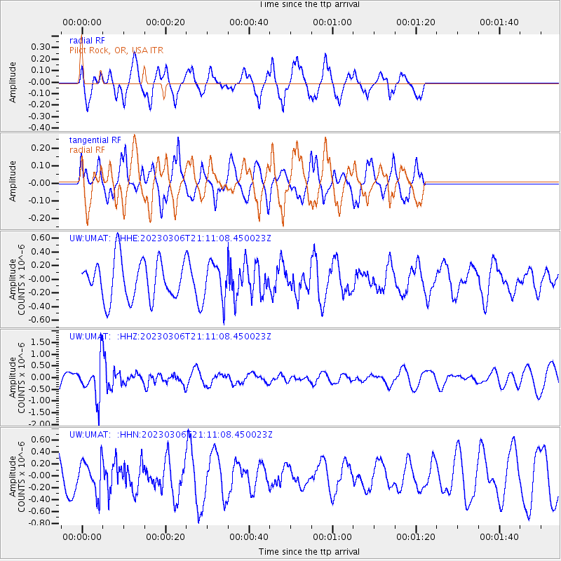
UMAT Pilot Rock, OR, USA - Earthquake Result Viewer
*The percent match for this event was below the threshold and hence no stack was calculated.
| Earthquake location: |
Fiji Islands Region |
| Earthquake latitude/longitude: |
-20.8/-178.3 |
| Earthquake time(UTC): |
2023/03/06 (065) 20:59:59 GMT |
| Earthquake Depth: |
526 km |
| Earthquake Magnitude: |
5.8 mww |
| Earthquake Catalog/Contributor: |
NEIC PDE/us |
|
| Network: |
UW Pacific Northwest Regional Seismic Network |
| Station: |
UMAT Pilot Rock, OR, USA |
| Lat/Lon: |
45.29 N/118.96 W |
| Elevation: |
1318 m |
|
| Distance: |
85.0 deg |
| Az: |
37.556 deg |
| Baz: |
233.9 deg |
| Ray Param: |
$rayparam |
*The percent match for this event was below the threshold and hence was not used in the summary stack. |
|
| Radial Match: |
72.794945 % |
| Radial Bump: |
385 |
| Transverse Match: |
58.673073 % |
| Transverse Bump: |
321 |
| SOD ConfigId: |
30536071 |
| Insert Time: |
2023-03-20 21:26:48.289 +0000 |
| GWidth: |
2.5 |
| Max Bumps: |
400 |
| Tol: |
0.001 |
|
Signal To Noise
| Channel | StoN | STA | LTA |
| UW:UMAT: :HHZ:20230306T21:11:08.450023Z | 2.3359666 | 7.8185883E-7 | 3.3470462E-7 |
| UW:UMAT: :HHN:20230306T21:11:08.450023Z | 0.9116854 | 2.7683666E-7 | 3.036537E-7 |
| UW:UMAT: :HHE:20230306T21:11:08.450023Z | 0.9325066 | 2.6670526E-7 | 2.8600897E-7 |
| Arrivals |
| Ps | |
| PpPs | |
| PsPs/PpSs | |


