You are here: Home > Network List > CN - Canadian National Seismograph Network Stations List
> Station INK INUVIK, NT > Earthquake Result Viewer
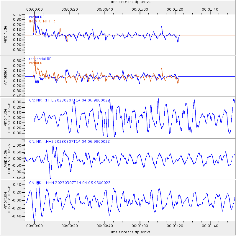
INK INUVIK, NT - Earthquake Result Viewer
*The percent match for this event was below the threshold and hence no stack was calculated.
| Earthquake location: |
New Ireland Region, P.N.G. |
| Earthquake latitude/longitude: |
-3.2/150.6 |
| Earthquake time(UTC): |
2023/03/07 (066) 13:51:49 GMT |
| Earthquake Depth: |
9.0 km |
| Earthquake Magnitude: |
5.9 mww |
| Earthquake Catalog/Contributor: |
NEIC PDE/us |
|
| Network: |
CN Canadian National Seismograph Network |
| Station: |
INK INUVIK, NT |
| Lat/Lon: |
68.31 N/133.53 W |
| Elevation: |
44 m |
|
| Distance: |
87.7 deg |
| Az: |
21.15 deg |
| Baz: |
255.697 deg |
| Ray Param: |
$rayparam |
*The percent match for this event was below the threshold and hence was not used in the summary stack. |
|
| Radial Match: |
67.53695 % |
| Radial Bump: |
400 |
| Transverse Match: |
40.813732 % |
| Transverse Bump: |
347 |
| SOD ConfigId: |
30536071 |
| Insert Time: |
2023-03-21 13:59:49.004 +0000 |
| GWidth: |
2.5 |
| Max Bumps: |
400 |
| Tol: |
0.001 |
|
Signal To Noise
| Channel | StoN | STA | LTA |
| CN:INK: :HHZ:20230307T14:04:06.980002Z | 0.86937046 | 1.5714834E-7 | 1.8076108E-7 |
| CN:INK: :HHN:20230307T14:04:06.980002Z | 1.7526441 | 3.482846E-7 | 1.9871953E-7 |
| CN:INK: :HHE:20230307T14:04:06.980002Z | 0.95084697 | 1.1565667E-7 | 1.2163541E-7 |
| Arrivals |
| Ps | |
| PpPs | |
| PsPs/PpSs | |


