You are here: Home > Network List > G - GEOSCOPE Stations List
> Station INU Inuyama, Japan > Earthquake Result Viewer
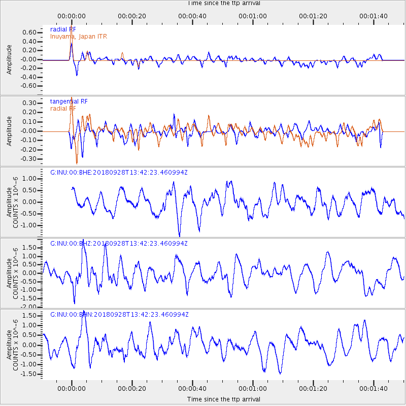
INU Inuyama, Japan - Earthquake Result Viewer
*The percent match for this event was below the threshold and hence no stack was calculated.
| Earthquake location: |
Minahassa Peninsula, Sulawesi |
| Earthquake latitude/longitude: |
0.1/119.7 |
| Earthquake time(UTC): |
2018/09/28 (271) 13:35:30 GMT |
| Earthquake Depth: |
10 km |
| Earthquake Magnitude: |
5.7 Ms_20 |
| Earthquake Catalog/Contributor: |
NEIC PDE/us |
|
| Network: |
G GEOSCOPE |
| Station: |
INU Inuyama, Japan |
| Lat/Lon: |
35.35 N/137.03 E |
| Elevation: |
132 m |
|
| Distance: |
38.7 deg |
| Az: |
22.964 deg |
| Baz: |
208.508 deg |
| Ray Param: |
$rayparam |
*The percent match for this event was below the threshold and hence was not used in the summary stack. |
|
| Radial Match: |
56.332424 % |
| Radial Bump: |
400 |
| Transverse Match: |
41.025684 % |
| Transverse Bump: |
400 |
| SOD ConfigId: |
3045211 |
| Insert Time: |
2018-10-12 13:46:58.412 +0000 |
| GWidth: |
2.5 |
| Max Bumps: |
400 |
| Tol: |
0.001 |
|
Signal To Noise
| Channel | StoN | STA | LTA |
| G:INU:00:BHZ:20180928T13:42:23.460994Z | 2.7602947 | 9.782221E-7 | 3.5439047E-7 |
| G:INU:00:BHN:20180928T13:42:23.460994Z | 2.4505703 | 9.780533E-7 | 3.9911254E-7 |
| G:INU:00:BHE:20180928T13:42:23.460994Z | 1.2616224 | 4.2803012E-7 | 3.392696E-7 |
| Arrivals |
| Ps | |
| PpPs | |
| PsPs/PpSs | |


