You are here: Home > Network List > GM - US Geological Survey Networks Stations List
> Station IWM01 Jericho 2M Well Monitoring Station > Earthquake Result Viewer
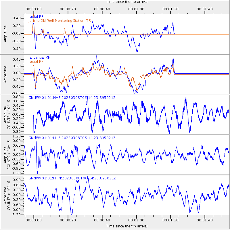
IWM01 Jericho 2M Well Monitoring Station - Earthquake Result Viewer
*The percent match for this event was below the threshold and hence no stack was calculated.
| Earthquake location: |
Kuril Islands |
| Earthquake latitude/longitude: |
50.1/157.4 |
| Earthquake time(UTC): |
2023/03/08 (067) 06:03:36 GMT |
| Earthquake Depth: |
36 km |
| Earthquake Magnitude: |
5.6 Mww |
| Earthquake Catalog/Contributor: |
NEIC PDE/us |
|
| Network: |
GM US Geological Survey Networks |
| Station: |
IWM01 Jericho 2M Well Monitoring Station |
| Lat/Lon: |
36.73 N/96.53 W |
| Elevation: |
328 m |
|
| Distance: |
71.8 deg |
| Az: |
54.393 deg |
| Baz: |
319.363 deg |
| Ray Param: |
$rayparam |
*The percent match for this event was below the threshold and hence was not used in the summary stack. |
|
| Radial Match: |
60.73464 % |
| Radial Bump: |
400 |
| Transverse Match: |
69.21693 % |
| Transverse Bump: |
400 |
| SOD ConfigId: |
30536071 |
| Insert Time: |
2023-03-22 06:17:57.954 +0000 |
| GWidth: |
2.5 |
| Max Bumps: |
400 |
| Tol: |
0.001 |
|
Signal To Noise
| Channel | StoN | STA | LTA |
| GM:IWM01:01:HHZ:20230308T06:14:23.895021Z | 1.9896135 | 6.7791285E-7 | 3.407259E-7 |
| GM:IWM01:01:HHN:20230308T06:14:23.895021Z | 1.0906087 | 4.0448688E-7 | 3.7088174E-7 |
| GM:IWM01:01:HHE:20230308T06:14:23.895021Z | 1.4451627 | 4.3130825E-7 | 2.984496E-7 |
| Arrivals |
| Ps | |
| PpPs | |
| PsPs/PpSs | |


