You are here: Home > Network List > IU - Global Seismograph Network (GSN - IRIS/USGS) Stations List
> Station RSSD Black Hills, South Dakota, USA > Earthquake Result Viewer
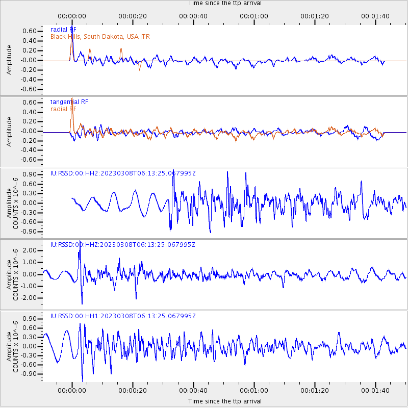
RSSD Black Hills, South Dakota, USA - Earthquake Result Viewer
*The percent match for this event was below the threshold and hence no stack was calculated.
| Earthquake location: |
Kuril Islands |
| Earthquake latitude/longitude: |
50.1/157.4 |
| Earthquake time(UTC): |
2023/03/08 (067) 06:03:36 GMT |
| Earthquake Depth: |
36 km |
| Earthquake Magnitude: |
5.6 Mww |
| Earthquake Catalog/Contributor: |
NEIC PDE/us |
|
| Network: |
IU Global Seismograph Network (GSN - IRIS/USGS) |
| Station: |
RSSD Black Hills, South Dakota, USA |
| Lat/Lon: |
44.12 N/104.04 W |
| Elevation: |
2090 m |
|
| Distance: |
62.5 deg |
| Az: |
53.44 deg |
| Baz: |
314.13 deg |
| Ray Param: |
$rayparam |
*The percent match for this event was below the threshold and hence was not used in the summary stack. |
|
| Radial Match: |
71.504265 % |
| Radial Bump: |
341 |
| Transverse Match: |
68.90801 % |
| Transverse Bump: |
400 |
| SOD ConfigId: |
30536071 |
| Insert Time: |
2023-03-22 06:20:26.431 +0000 |
| GWidth: |
2.5 |
| Max Bumps: |
400 |
| Tol: |
0.001 |
|
Signal To Noise
| Channel | StoN | STA | LTA |
| IU:RSSD:00:HHZ:20230308T06:13:25.067995Z | 6.297055 | 1.0026166E-6 | 1.5921994E-7 |
| IU:RSSD:00:HH1:20230308T06:13:25.067995Z | 1.5153356 | 4.3691688E-7 | 2.883301E-7 |
| IU:RSSD:00:HH2:20230308T06:13:25.067995Z | 2.0808578 | 4.1795127E-7 | 2.0085528E-7 |
| Arrivals |
| Ps | |
| PpPs | |
| PsPs/PpSs | |


