You are here: Home > Network List > GS - US Geological Survey Networks Stations List
> Station KAN13 Rinehart Farm > Earthquake Result Viewer
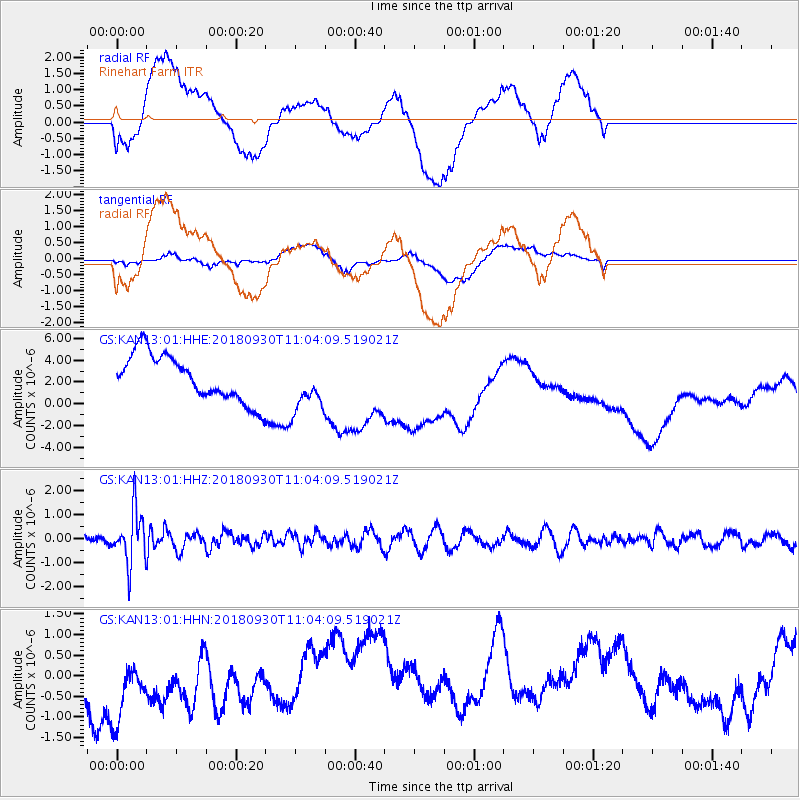
KAN13 Rinehart Farm - Earthquake Result Viewer
*The percent match for this event was below the threshold and hence no stack was calculated.
| Earthquake location: |
Fiji Islands Region |
| Earthquake latitude/longitude: |
-18.4/-178.1 |
| Earthquake time(UTC): |
2018/09/30 (273) 10:52:23 GMT |
| Earthquake Depth: |
551 km |
| Earthquake Magnitude: |
6.6 mww |
| Earthquake Catalog/Contributor: |
NEIC PDE/us |
|
| Network: |
GS US Geological Survey Networks |
| Station: |
KAN13 Rinehart Farm |
| Lat/Lon: |
37.01 N/97.48 W |
| Elevation: |
340 m |
|
| Distance: |
93.7 deg |
| Az: |
52.311 deg |
| Baz: |
249.863 deg |
| Ray Param: |
$rayparam |
*The percent match for this event was below the threshold and hence was not used in the summary stack. |
|
| Radial Match: |
19.054398 % |
| Radial Bump: |
400 |
| Transverse Match: |
52.899075 % |
| Transverse Bump: |
400 |
| SOD ConfigId: |
3045211 |
| Insert Time: |
2018-10-14 11:08:43.043 +0000 |
| GWidth: |
2.5 |
| Max Bumps: |
400 |
| Tol: |
0.001 |
|
Signal To Noise
| Channel | StoN | STA | LTA |
| GS:KAN13:01:HHZ:20180930T11:04:09.519021Z | 2.857317 | 1.0889622E-6 | 3.8111352E-7 |
| GS:KAN13:01:HHN:20180930T11:04:09.519021Z | 2.159853 | 1.464522E-6 | 6.780656E-7 |
| GS:KAN13:01:HHE:20180930T11:04:09.519021Z | 1.1283385 | 2.4092078E-6 | 2.1351818E-6 |
| Arrivals |
| Ps | |
| PpPs | |
| PsPs/PpSs | |


