You are here: Home > Network List > US - United States National Seismic Network Stations List
> Station GLMI Grayling, Michigan, USA > Earthquake Result Viewer
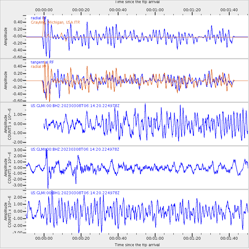
GLMI Grayling, Michigan, USA - Earthquake Result Viewer
*The percent match for this event was below the threshold and hence no stack was calculated.
| Earthquake location: |
Kuril Islands |
| Earthquake latitude/longitude: |
50.1/157.4 |
| Earthquake time(UTC): |
2023/03/08 (067) 06:03:36 GMT |
| Earthquake Depth: |
36 km |
| Earthquake Magnitude: |
5.6 Mww |
| Earthquake Catalog/Contributor: |
NEIC PDE/us |
|
| Network: |
US United States National Seismic Network |
| Station: |
GLMI Grayling, Michigan, USA |
| Lat/Lon: |
44.82 N/84.62 W |
| Elevation: |
387 m |
|
| Distance: |
71.1 deg |
| Az: |
41.629 deg |
| Baz: |
323.076 deg |
| Ray Param: |
$rayparam |
*The percent match for this event was below the threshold and hence was not used in the summary stack. |
|
| Radial Match: |
60.581367 % |
| Radial Bump: |
400 |
| Transverse Match: |
75.6396 % |
| Transverse Bump: |
400 |
| SOD ConfigId: |
30536071 |
| Insert Time: |
2023-03-22 06:36:50.918 +0000 |
| GWidth: |
2.5 |
| Max Bumps: |
400 |
| Tol: |
0.001 |
|
Signal To Noise
| Channel | StoN | STA | LTA |
| US:GLMI:00:BHZ:20230308T06:14:20.224978Z | 3.1211174 | 1.3893413E-6 | 4.4514226E-7 |
| US:GLMI:00:BH1:20230308T06:14:20.224978Z | 2.0721457 | 1.2918326E-6 | 6.234275E-7 |
| US:GLMI:00:BH2:20230308T06:14:20.224978Z | 1.2826039 | 5.9467595E-7 | 4.636474E-7 |
| Arrivals |
| Ps | |
| PpPs | |
| PsPs/PpSs | |


