You are here: Home > Network List > US - United States National Seismic Network Stations List
> Station WMOK Wichita Mountains, Oklahoma, USA > Earthquake Result Viewer
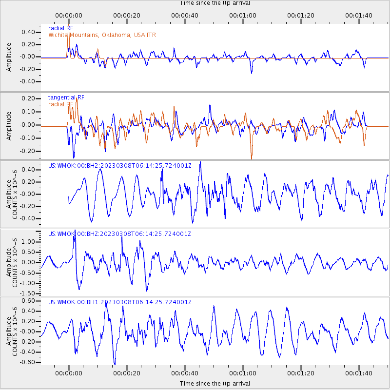
WMOK Wichita Mountains, Oklahoma, USA - Earthquake Result Viewer
*The percent match for this event was below the threshold and hence no stack was calculated.
| Earthquake location: |
Kuril Islands |
| Earthquake latitude/longitude: |
50.1/157.4 |
| Earthquake time(UTC): |
2023/03/08 (067) 06:03:36 GMT |
| Earthquake Depth: |
36 km |
| Earthquake Magnitude: |
5.6 Mww |
| Earthquake Catalog/Contributor: |
NEIC PDE/us |
|
| Network: |
US United States National Seismic Network |
| Station: |
WMOK Wichita Mountains, Oklahoma, USA |
| Lat/Lon: |
34.74 N/98.78 W |
| Elevation: |
486 m |
|
| Distance: |
72.1 deg |
| Az: |
57.215 deg |
| Baz: |
318.931 deg |
| Ray Param: |
$rayparam |
*The percent match for this event was below the threshold and hence was not used in the summary stack. |
|
| Radial Match: |
55.16509 % |
| Radial Bump: |
400 |
| Transverse Match: |
61.606407 % |
| Transverse Bump: |
400 |
| SOD ConfigId: |
30536071 |
| Insert Time: |
2023-03-22 06:37:32.392 +0000 |
| GWidth: |
2.5 |
| Max Bumps: |
400 |
| Tol: |
0.001 |
|
Signal To Noise
| Channel | StoN | STA | LTA |
| US:WMOK:00:BHZ:20230308T06:14:25.724001Z | 3.1715548 | 7.7047537E-7 | 2.4293303E-7 |
| US:WMOK:00:BH1:20230308T06:14:25.724001Z | 1.3144405 | 1.9962765E-7 | 1.5187273E-7 |
| US:WMOK:00:BH2:20230308T06:14:25.724001Z | 0.71238774 | 1.6016867E-7 | 2.2483356E-7 |
| Arrivals |
| Ps | |
| PpPs | |
| PsPs/PpSs | |


