You are here: Home > Network List > IU - Global Seismograph Network (GSN - IRIS/USGS) Stations List
> Station RSSD Black Hills, South Dakota, USA > Earthquake Result Viewer
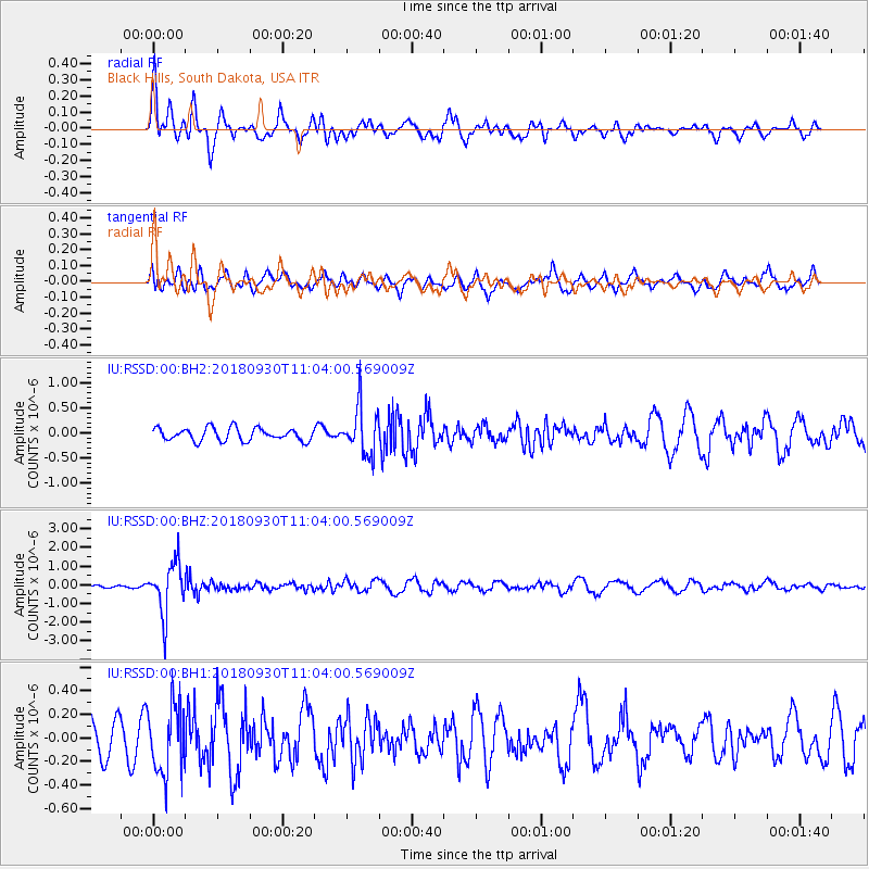
RSSD Black Hills, South Dakota, USA - Earthquake Result Viewer
*The percent match for this event was below the threshold and hence no stack was calculated.
| Earthquake location: |
Fiji Islands Region |
| Earthquake latitude/longitude: |
-18.4/-178.1 |
| Earthquake time(UTC): |
2018/09/30 (273) 10:52:23 GMT |
| Earthquake Depth: |
551 km |
| Earthquake Magnitude: |
6.6 mww |
| Earthquake Catalog/Contributor: |
NEIC PDE/us |
|
| Network: |
IU Global Seismograph Network (GSN - IRIS/USGS) |
| Station: |
RSSD Black Hills, South Dakota, USA |
| Lat/Lon: |
44.12 N/104.04 W |
| Elevation: |
2090 m |
|
| Distance: |
91.7 deg |
| Az: |
43.853 deg |
| Baz: |
245.999 deg |
| Ray Param: |
$rayparam |
*The percent match for this event was below the threshold and hence was not used in the summary stack. |
|
| Radial Match: |
73.21085 % |
| Radial Bump: |
400 |
| Transverse Match: |
65.07564 % |
| Transverse Bump: |
400 |
| SOD ConfigId: |
3045211 |
| Insert Time: |
2018-10-14 11:09:50.315 +0000 |
| GWidth: |
2.5 |
| Max Bumps: |
400 |
| Tol: |
0.001 |
|
Signal To Noise
| Channel | StoN | STA | LTA |
| IU:RSSD:00:BHZ:20180930T11:04:00.569009Z | 16.07403 | 1.3427726E-6 | 8.3536776E-8 |
| IU:RSSD:00:BH1:20180930T11:04:00.569009Z | 2.5107226 | 2.9248434E-7 | 1.1649409E-7 |
| IU:RSSD:00:BH2:20180930T11:04:00.569009Z | 3.7434173 | 4.7376616E-7 | 1.265598E-7 |
| Arrivals |
| Ps | |
| PpPs | |
| PsPs/PpSs | |


