You are here: Home > Network List > G - GEOSCOPE Stations List
> Station INU Inuyama, Japan > Earthquake Result Viewer
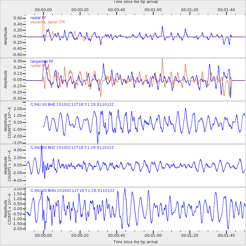
INU Inuyama, Japan - Earthquake Result Viewer
*The percent match for this event was below the threshold and hence no stack was calculated.
| Earthquake location: |
South Of Java, Indonesia |
| Earthquake latitude/longitude: |
-9.9/113.8 |
| Earthquake time(UTC): |
2010/02/11 (042) 18:43:09 GMT |
| Earthquake Depth: |
51 km |
| Earthquake Magnitude: |
5.9 MB, 5.3 MS, 5.8 MW, 5.7 MW |
| Earthquake Catalog/Contributor: |
WHDF/NEIC |
|
| Network: |
G GEOSCOPE |
| Station: |
INU Inuyama, Japan |
| Lat/Lon: |
35.35 N/137.03 E |
| Elevation: |
132 m |
|
| Distance: |
50.1 deg |
| Az: |
24.817 deg |
| Baz: |
210.391 deg |
| Ray Param: |
$rayparam |
*The percent match for this event was below the threshold and hence was not used in the summary stack. |
|
| Radial Match: |
48.76365 % |
| Radial Bump: |
400 |
| Transverse Match: |
44.35343 % |
| Transverse Bump: |
400 |
| SOD ConfigId: |
305946 |
| Insert Time: |
2010-05-04 06:45:50.221 +0000 |
| GWidth: |
2.5 |
| Max Bumps: |
400 |
| Tol: |
0.001 |
|
Signal To Noise
| Channel | StoN | STA | LTA |
| G:INU:00:BHZ:20100211T18:51:28.811013Z | 2.4276986 | 1.645199E-6 | 6.7767843E-7 |
| G:INU:00:BHN:20100211T18:51:28.811013Z | 1.2787961 | 1.0869994E-6 | 8.500178E-7 |
| G:INU:00:BHE:20100211T18:51:28.811013Z | 1.8345387 | 1.3814469E-6 | 7.5302137E-7 |
| Arrivals |
| Ps | |
| PpPs | |
| PsPs/PpSs | |


