You are here: Home > Network List > CI - Caltech Regional Seismic Network Stations List
> Station DGR Domenigoni Reservoir, California, USA > Earthquake Result Viewer
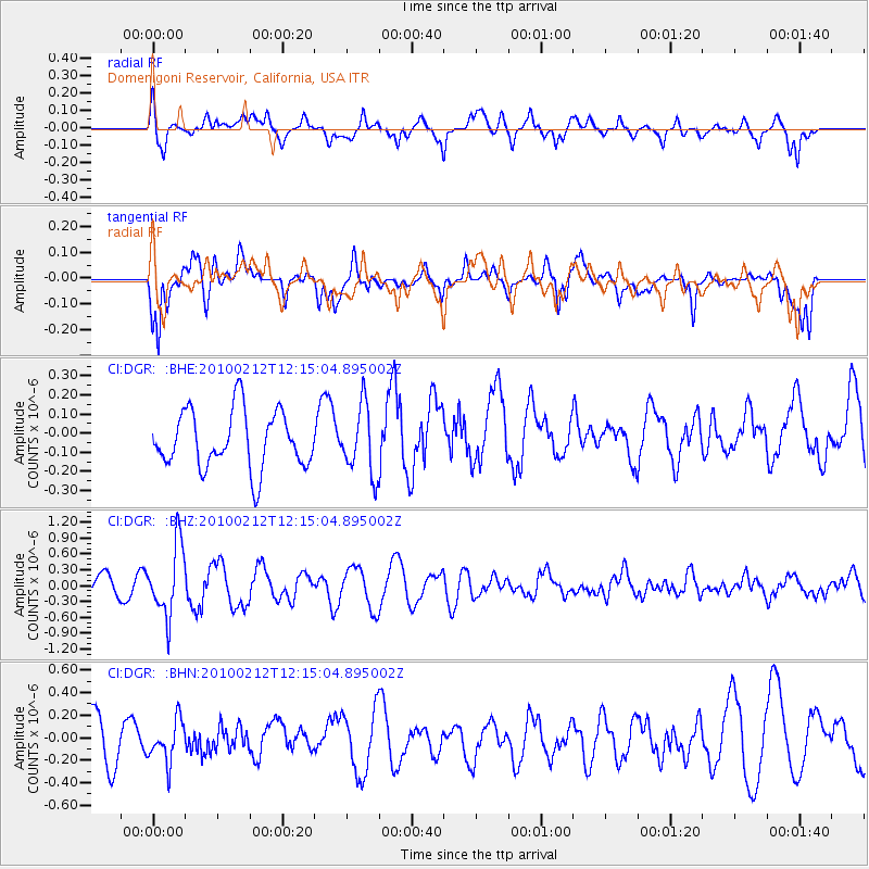
DGR Domenigoni Reservoir, California, USA - Earthquake Result Viewer
*The percent match for this event was below the threshold and hence no stack was calculated.
| Earthquake location: |
Mendoza Province, Argentina |
| Earthquake latitude/longitude: |
-33.6/-68.8 |
| Earthquake time(UTC): |
2010/02/12 (043) 12:03:38 GMT |
| Earthquake Depth: |
148 km |
| Earthquake Magnitude: |
5.6 MB, 5.8 MW, 5.8 MW |
| Earthquake Catalog/Contributor: |
WHDF/NEIC |
|
| Network: |
CI Caltech Regional Seismic Network |
| Station: |
DGR Domenigoni Reservoir, California, USA |
| Lat/Lon: |
33.65 N/117.01 W |
| Elevation: |
609 m |
|
| Distance: |
80.8 deg |
| Az: |
320.94 deg |
| Baz: |
140.925 deg |
| Ray Param: |
$rayparam |
*The percent match for this event was below the threshold and hence was not used in the summary stack. |
|
| Radial Match: |
61.10097 % |
| Radial Bump: |
400 |
| Transverse Match: |
65.54064 % |
| Transverse Bump: |
400 |
| SOD ConfigId: |
306082 |
| Insert Time: |
2010-05-06 06:37:09.437 +0000 |
| GWidth: |
2.5 |
| Max Bumps: |
400 |
| Tol: |
0.001 |
|
Signal To Noise
| Channel | StoN | STA | LTA |
| CI:DGR: :BHZ:20100212T12:15:04.895002Z | 3.033373 | 6.631267E-7 | 2.1861034E-7 |
| CI:DGR: :BHN:20100212T12:15:04.895002Z | 1.2025274 | 1.883484E-7 | 1.5662711E-7 |
| CI:DGR: :BHE:20100212T12:15:04.895002Z | 1.1931132 | 1.7822939E-7 | 1.493818E-7 |
| Arrivals |
| Ps | |
| PpPs | |
| PsPs/PpSs | |


