You are here: Home > Network List > US - United States National Seismic Network Stations List
> Station WUAZ Wupatki, Arizona, USA > Earthquake Result Viewer
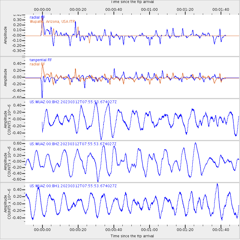
WUAZ Wupatki, Arizona, USA - Earthquake Result Viewer
*The percent match for this event was below the threshold and hence no stack was calculated.
| Earthquake location: |
Santa Cruz Islands |
| Earthquake latitude/longitude: |
-12.1/165.8 |
| Earthquake time(UTC): |
2023/03/12 (071) 07:43:20 GMT |
| Earthquake Depth: |
10 km |
| Earthquake Magnitude: |
5.7 mww |
| Earthquake Catalog/Contributor: |
NEIC PDE/us |
|
| Network: |
US United States National Seismic Network |
| Station: |
WUAZ Wupatki, Arizona, USA |
| Lat/Lon: |
35.52 N/111.37 W |
| Elevation: |
1592 m |
|
| Distance: |
91.1 deg |
| Az: |
54.049 deg |
| Baz: |
256.098 deg |
| Ray Param: |
$rayparam |
*The percent match for this event was below the threshold and hence was not used in the summary stack. |
|
| Radial Match: |
64.52148 % |
| Radial Bump: |
393 |
| Transverse Match: |
63.295998 % |
| Transverse Bump: |
400 |
| SOD ConfigId: |
30536071 |
| Insert Time: |
2023-03-26 08:01:30.619 +0000 |
| GWidth: |
2.5 |
| Max Bumps: |
400 |
| Tol: |
0.001 |
|
Signal To Noise
| Channel | StoN | STA | LTA |
| US:WUAZ:00:BHZ:20230312T07:55:53.674027Z | 0.8394037 | 1.7119604E-7 | 2.0394957E-7 |
| US:WUAZ:00:BH1:20230312T07:55:53.674027Z | 1.0151448 | 2.2658583E-7 | 2.2320542E-7 |
| US:WUAZ:00:BH2:20230312T07:55:53.674027Z | 2.1299405 | 3.6808385E-7 | 1.7281414E-7 |
| Arrivals |
| Ps | |
| PpPs | |
| PsPs/PpSs | |


