You are here: Home > Network List > G - GEOSCOPE Stations List
> Station UNM Unam,Mexico > Earthquake Result Viewer
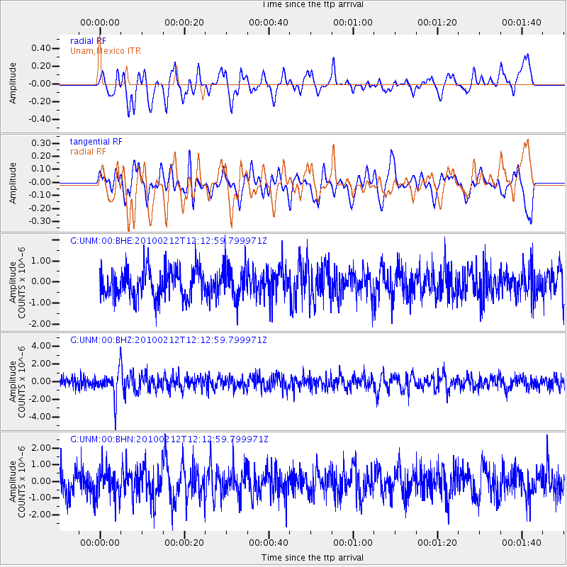
UNM Unam,Mexico - Earthquake Result Viewer
*The percent match for this event was below the threshold and hence no stack was calculated.
| Earthquake location: |
Mendoza Province, Argentina |
| Earthquake latitude/longitude: |
-33.6/-68.8 |
| Earthquake time(UTC): |
2010/02/12 (043) 12:03:38 GMT |
| Earthquake Depth: |
148 km |
| Earthquake Magnitude: |
5.6 MB, 5.8 MW, 5.8 MW |
| Earthquake Catalog/Contributor: |
WHDF/NEIC |
|
| Network: |
G GEOSCOPE |
| Station: |
UNM Unam,Mexico |
| Lat/Lon: |
19.33 N/99.18 W |
| Elevation: |
2280 m |
|
| Distance: |
60.1 deg |
| Az: |
326.564 deg |
| Baz: |
150.864 deg |
| Ray Param: |
$rayparam |
*The percent match for this event was below the threshold and hence was not used in the summary stack. |
|
| Radial Match: |
53.11938 % |
| Radial Bump: |
400 |
| Transverse Match: |
57.757927 % |
| Transverse Bump: |
400 |
| SOD ConfigId: |
306082 |
| Insert Time: |
2010-05-06 06:39:24.490 +0000 |
| GWidth: |
2.5 |
| Max Bumps: |
400 |
| Tol: |
0.001 |
|
Signal To Noise
| Channel | StoN | STA | LTA |
| G:UNM:00:BHZ:20100212T12:12:59.799971Z | 3.103507 | 1.5535094E-6 | 5.0056576E-7 |
| G:UNM:00:BHN:20100212T12:12:59.799971Z | 0.9961115 | 8.249234E-7 | 8.2814364E-7 |
| G:UNM:00:BHE:20100212T12:12:59.799971Z | 1.1597533 | 7.958989E-7 | 6.862657E-7 |
| Arrivals |
| Ps | |
| PpPs | |
| PsPs/PpSs | |


