You are here: Home > Network List > US - United States National Seismic Network Stations List
> Station WUAZ Wupatki, Arizona, USA > Earthquake Result Viewer
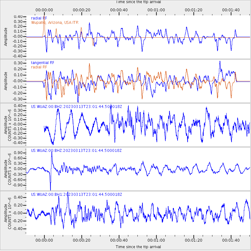
WUAZ Wupatki, Arizona, USA - Earthquake Result Viewer
*The percent match for this event was below the threshold and hence no stack was calculated.
| Earthquake location: |
La Rioja Province, Argentina |
| Earthquake latitude/longitude: |
-28.2/-67.6 |
| Earthquake time(UTC): |
2023/03/13 (072) 22:50:45 GMT |
| Earthquake Depth: |
137 km |
| Earthquake Magnitude: |
5.2 Mww |
| Earthquake Catalog/Contributor: |
NEIC PDE/us |
|
| Network: |
US United States National Seismic Network |
| Station: |
WUAZ Wupatki, Arizona, USA |
| Lat/Lon: |
35.52 N/111.37 W |
| Elevation: |
1592 m |
|
| Distance: |
75.6 deg |
| Az: |
324.354 deg |
| Baz: |
140.899 deg |
| Ray Param: |
$rayparam |
*The percent match for this event was below the threshold and hence was not used in the summary stack. |
|
| Radial Match: |
64.88991 % |
| Radial Bump: |
400 |
| Transverse Match: |
59.562668 % |
| Transverse Bump: |
400 |
| SOD ConfigId: |
30536071 |
| Insert Time: |
2023-03-27 23:10:32.237 +0000 |
| GWidth: |
2.5 |
| Max Bumps: |
400 |
| Tol: |
0.001 |
|
Signal To Noise
| Channel | StoN | STA | LTA |
| US:WUAZ:00:BHZ:20230313T23:01:44.500018Z | 3.6567428 | 3.8703175E-7 | 1.0584057E-7 |
| US:WUAZ:00:BH1:20230313T23:01:44.500018Z | 0.7089732 | 8.3934324E-8 | 1.1838856E-7 |
| US:WUAZ:00:BH2:20230313T23:01:44.500018Z | 0.39804757 | 7.727416E-8 | 1.9413298E-7 |
| Arrivals |
| Ps | |
| PpPs | |
| PsPs/PpSs | |


