You are here: Home > Network List > TA - USArray Transportable Network (new EarthScope stations) Stations List
> Station U23A El Rito, NM, USA > Earthquake Result Viewer
U23A El Rito, NM, USA - Earthquake Result Viewer
*The percent match for this event was below the threshold and hence no stack was calculated.
| Earthquake location: |
Mendoza Province, Argentina |
| Earthquake latitude/longitude: |
-33.6/-68.8 |
| Earthquake time(UTC): |
2010/02/12 (043) 12:03:38 GMT |
| Earthquake Depth: |
148 km |
| Earthquake Magnitude: |
5.6 MB, 5.8 MW, 5.8 MW |
| Earthquake Catalog/Contributor: |
WHDF/NEIC |
|
| Network: |
TA USArray Transportable Network (new EarthScope stations) |
| Station: |
U23A El Rito, NM, USA |
| Lat/Lon: |
36.33 N/106.19 W |
| Elevation: |
2093 m |
|
| Distance: |
77.9 deg |
| Az: |
329.887 deg |
| Baz: |
148.774 deg |
| Ray Param: |
$rayparam |
*The percent match for this event was below the threshold and hence was not used in the summary stack. |
|
| Radial Match: |
56.33104 % |
| Radial Bump: |
400 |
| Transverse Match: |
66.36125 % |
| Transverse Bump: |
364 |
| SOD ConfigId: |
306082 |
| Insert Time: |
2010-05-06 06:46:29.067 +0000 |
| GWidth: |
2.5 |
| Max Bumps: |
400 |
| Tol: |
0.001 |
|
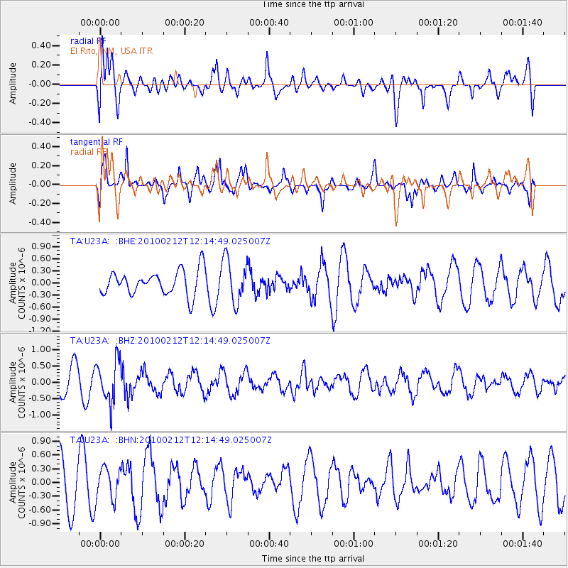
Signal To Noise
| Channel | StoN | STA | LTA |
| TA:U23A: :BHZ:20100212T12:14:49.025007Z | 2.2653847 | 6.467881E-7 | 2.8550917E-7 |
| TA:U23A: :BHN:20100212T12:14:49.025007Z | 0.66652954 | 3.3033686E-7 | 4.9560725E-7 |
| TA:U23A: :BHE:20100212T12:14:49.025007Z | 1.8100004 | 5.5184347E-7 | 3.0488584E-7 |
| Arrivals |
| Ps | |
| PpPs | |
| PsPs/PpSs | |


