You are here: Home > Network List > TA - USArray Transportable Network (new EarthScope stations) Stations List
> Station U22A Llaves, NM, USA > Earthquake Result Viewer
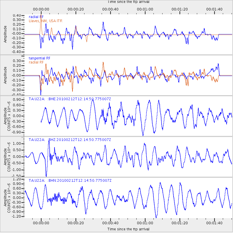
U22A Llaves, NM, USA - Earthquake Result Viewer
*The percent match for this event was below the threshold and hence no stack was calculated.
| Earthquake location: |
Mendoza Province, Argentina |
| Earthquake latitude/longitude: |
-33.6/-68.8 |
| Earthquake time(UTC): |
2010/02/12 (043) 12:03:38 GMT |
| Earthquake Depth: |
148 km |
| Earthquake Magnitude: |
5.6 MB, 5.8 MW, 5.8 MW |
| Earthquake Catalog/Contributor: |
WHDF/NEIC |
|
| Network: |
TA USArray Transportable Network (new EarthScope stations) |
| Station: |
U22A Llaves, NM, USA |
| Lat/Lon: |
36.38 N/106.85 W |
| Elevation: |
2119 m |
|
| Distance: |
78.2 deg |
| Az: |
329.446 deg |
| Baz: |
148.291 deg |
| Ray Param: |
$rayparam |
*The percent match for this event was below the threshold and hence was not used in the summary stack. |
|
| Radial Match: |
45.332336 % |
| Radial Bump: |
361 |
| Transverse Match: |
59.29889 % |
| Transverse Bump: |
400 |
| SOD ConfigId: |
306082 |
| Insert Time: |
2010-05-06 06:46:32.572 +0000 |
| GWidth: |
2.5 |
| Max Bumps: |
400 |
| Tol: |
0.001 |
|
Signal To Noise
| Channel | StoN | STA | LTA |
| TA:U22A: :BHZ:20100212T12:14:50.775007Z | 3.535067 | 6.857923E-7 | 1.9399697E-7 |
| TA:U22A: :BHN:20100212T12:14:50.775007Z | 1.9000225 | 5.049653E-7 | 2.6576808E-7 |
| TA:U22A: :BHE:20100212T12:14:50.775007Z | 1.8429819 | 5.5841116E-7 | 3.029933E-7 |
| Arrivals |
| Ps | |
| PpPs | |
| PsPs/PpSs | |


