You are here: Home > Network List > TA - USArray Transportable Network (new EarthScope stations) Stations List
> Station H20A Greybull, WY, USA > Earthquake Result Viewer
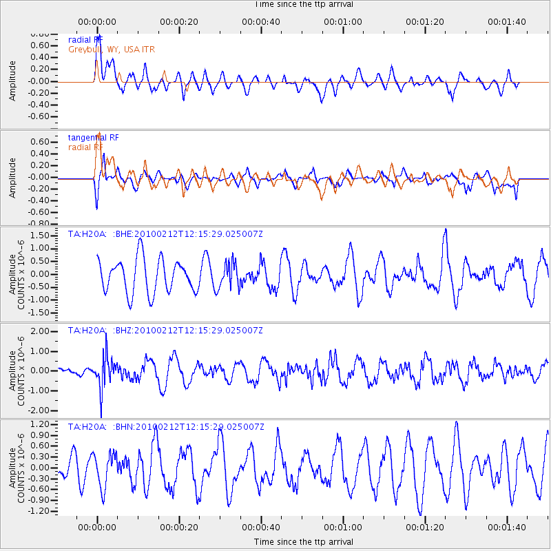
H20A Greybull, WY, USA - Earthquake Result Viewer
*The percent match for this event was below the threshold and hence no stack was calculated.
| Earthquake location: |
Mendoza Province, Argentina |
| Earthquake latitude/longitude: |
-33.6/-68.8 |
| Earthquake time(UTC): |
2010/02/12 (043) 12:03:38 GMT |
| Earthquake Depth: |
148 km |
| Earthquake Magnitude: |
5.6 MB, 5.8 MW, 5.8 MW |
| Earthquake Catalog/Contributor: |
WHDF/NEIC |
|
| Network: |
TA USArray Transportable Network (new EarthScope stations) |
| Station: |
H20A Greybull, WY, USA |
| Lat/Lon: |
44.49 N/108.00 W |
| Elevation: |
1236 m |
|
| Distance: |
85.5 deg |
| Az: |
333.009 deg |
| Baz: |
148.056 deg |
| Ray Param: |
$rayparam |
*The percent match for this event was below the threshold and hence was not used in the summary stack. |
|
| Radial Match: |
64.01052 % |
| Radial Bump: |
400 |
| Transverse Match: |
62.266384 % |
| Transverse Bump: |
400 |
| SOD ConfigId: |
306082 |
| Insert Time: |
2010-05-06 06:47:44.828 +0000 |
| GWidth: |
2.5 |
| Max Bumps: |
400 |
| Tol: |
0.001 |
|
Signal To Noise
| Channel | StoN | STA | LTA |
| TA:H20A: :BHZ:20100212T12:15:29.025007Z | 2.817619 | 8.00544E-7 | 2.8412074E-7 |
| TA:H20A: :BHN:20100212T12:15:29.025007Z | 1.0622765 | 4.7282379E-7 | 4.4510423E-7 |
| TA:H20A: :BHE:20100212T12:15:29.025007Z | 0.7455223 | 4.857441E-7 | 6.5154876E-7 |
| Arrivals |
| Ps | |
| PpPs | |
| PsPs/PpSs | |


