You are here: Home > Network List > US - United States National Seismic Network Stations List
> Station DGMT Dagmar, Montana, USA > Earthquake Result Viewer
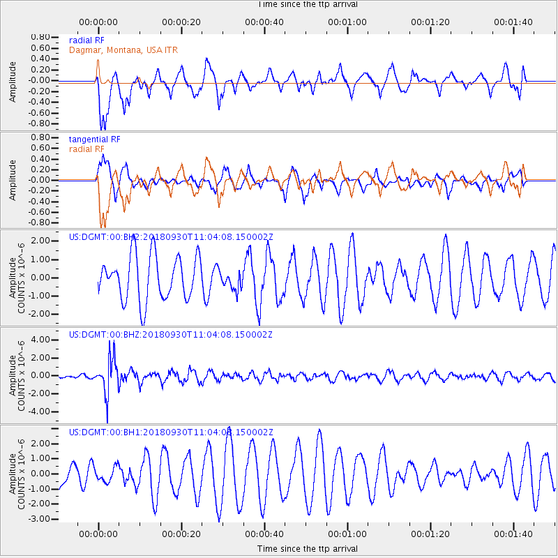
DGMT Dagmar, Montana, USA - Earthquake Result Viewer
*The percent match for this event was below the threshold and hence no stack was calculated.
| Earthquake location: |
Fiji Islands Region |
| Earthquake latitude/longitude: |
-18.4/-178.1 |
| Earthquake time(UTC): |
2018/09/30 (273) 10:52:23 GMT |
| Earthquake Depth: |
551 km |
| Earthquake Magnitude: |
6.6 mww |
| Earthquake Catalog/Contributor: |
NEIC PDE/us |
|
| Network: |
US United States National Seismic Network |
| Station: |
DGMT Dagmar, Montana, USA |
| Lat/Lon: |
48.47 N/104.20 W |
| Elevation: |
0.0 m |
|
| Distance: |
93.4 deg |
| Az: |
39.829 deg |
| Baz: |
246.061 deg |
| Ray Param: |
$rayparam |
*The percent match for this event was below the threshold and hence was not used in the summary stack. |
|
| Radial Match: |
48.096153 % |
| Radial Bump: |
368 |
| Transverse Match: |
48.14604 % |
| Transverse Bump: |
371 |
| SOD ConfigId: |
3045211 |
| Insert Time: |
2018-10-14 11:12:31.371 +0000 |
| GWidth: |
2.5 |
| Max Bumps: |
400 |
| Tol: |
0.001 |
|
Signal To Noise
| Channel | StoN | STA | LTA |
| US:DGMT:00:BHZ:20180930T11:04:08.150002Z | 7.5251083 | 1.9258093E-6 | 2.5591783E-7 |
| US:DGMT:00:BH1:20180930T11:04:08.150002Z | 0.39234158 | 4.884197E-7 | 1.2448838E-6 |
| US:DGMT:00:BH2:20180930T11:04:08.150002Z | 0.41397923 | 5.0258916E-7 | 1.2140445E-6 |
| Arrivals |
| Ps | |
| PpPs | |
| PsPs/PpSs | |


