You are here: Home > Network List > US - United States National Seismic Network Stations List
> Station EGMT Eagleton, Montana, USA > Earthquake Result Viewer
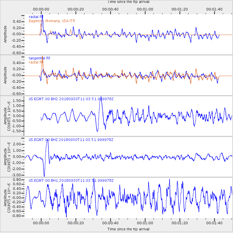
EGMT Eagleton, Montana, USA - Earthquake Result Viewer
*The percent match for this event was below the threshold and hence no stack was calculated.
| Earthquake location: |
Fiji Islands Region |
| Earthquake latitude/longitude: |
-18.4/-178.1 |
| Earthquake time(UTC): |
2018/09/30 (273) 10:52:23 GMT |
| Earthquake Depth: |
551 km |
| Earthquake Magnitude: |
6.6 mww |
| Earthquake Catalog/Contributor: |
NEIC PDE/us |
|
| Network: |
US United States National Seismic Network |
| Station: |
EGMT Eagleton, Montana, USA |
| Lat/Lon: |
48.02 N/109.75 W |
| Elevation: |
1055 m |
|
| Distance: |
89.8 deg |
| Az: |
38.602 deg |
| Baz: |
241.959 deg |
| Ray Param: |
$rayparam |
*The percent match for this event was below the threshold and hence was not used in the summary stack. |
|
| Radial Match: |
69.684456 % |
| Radial Bump: |
400 |
| Transverse Match: |
58.950584 % |
| Transverse Bump: |
400 |
| SOD ConfigId: |
3045211 |
| Insert Time: |
2018-10-14 11:12:35.094 +0000 |
| GWidth: |
2.5 |
| Max Bumps: |
400 |
| Tol: |
0.001 |
|
Signal To Noise
| Channel | StoN | STA | LTA |
| US:EGMT:00:BHZ:20180930T11:03:51.999978Z | 10.472224 | 1.6242112E-6 | 1.5509706E-7 |
| US:EGMT:00:BH1:20180930T11:03:51.999978Z | 0.8847932 | 3.2576955E-7 | 3.6818722E-7 |
| US:EGMT:00:BH2:20180930T11:03:51.999978Z | 3.2786853 | 1.017462E-6 | 3.103262E-7 |
| Arrivals |
| Ps | |
| PpPs | |
| PsPs/PpSs | |


