You are here: Home > Network List > TA - USArray Transportable Network (new EarthScope stations) Stations List
> Station 430A Baggett Ranch, Ozona, TX, USA > Earthquake Result Viewer
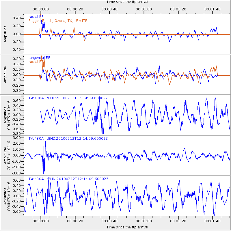
430A Baggett Ranch, Ozona, TX, USA - Earthquake Result Viewer
*The percent match for this event was below the threshold and hence no stack was calculated.
| Earthquake location: |
Mendoza Province, Argentina |
| Earthquake latitude/longitude: |
-33.6/-68.8 |
| Earthquake time(UTC): |
2010/02/12 (043) 12:03:38 GMT |
| Earthquake Depth: |
148 km |
| Earthquake Magnitude: |
5.6 MB, 5.8 MW, 5.8 MW |
| Earthquake Catalog/Contributor: |
WHDF/NEIC |
|
| Network: |
TA USArray Transportable Network (new EarthScope stations) |
| Station: |
430A Baggett Ranch, Ozona, TX, USA |
| Lat/Lon: |
30.79 N/101.24 W |
| Elevation: |
768 m |
|
| Distance: |
71.0 deg |
| Az: |
330.773 deg |
| Baz: |
151.743 deg |
| Ray Param: |
$rayparam |
*The percent match for this event was below the threshold and hence was not used in the summary stack. |
|
| Radial Match: |
35.491062 % |
| Radial Bump: |
400 |
| Transverse Match: |
45.295464 % |
| Transverse Bump: |
351 |
| SOD ConfigId: |
306082 |
| Insert Time: |
2010-05-06 06:54:35.643 +0000 |
| GWidth: |
2.5 |
| Max Bumps: |
400 |
| Tol: |
0.001 |
|
Signal To Noise
| Channel | StoN | STA | LTA |
| TA:430A: :BHZ:20100212T12:14:09.60002Z | 4.347188 | 1.0901396E-6 | 2.507689E-7 |
| TA:430A: :BHN:20100212T12:14:09.60002Z | 1.2789303 | 3.205678E-7 | 2.5065307E-7 |
| TA:430A: :BHE:20100212T12:14:09.60002Z | 1.2038532 | 2.9923459E-7 | 2.48564E-7 |
| Arrivals |
| Ps | |
| PpPs | |
| PsPs/PpSs | |


