You are here: Home > Network List > TA - USArray Transportable Network (new EarthScope stations) Stations List
> Station S30A Montezuma, KS, USA > Earthquake Result Viewer
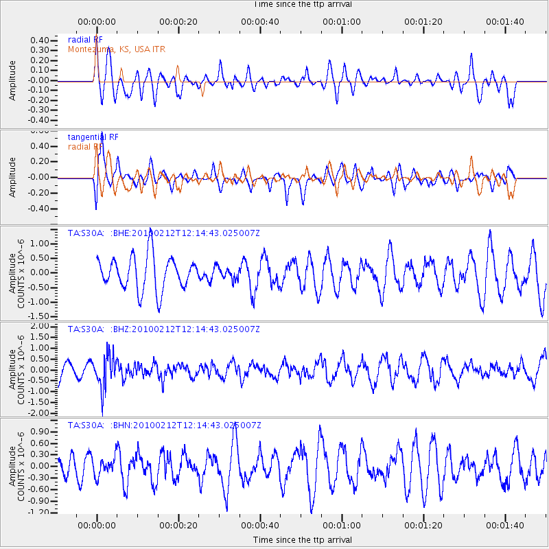
S30A Montezuma, KS, USA - Earthquake Result Viewer
*The percent match for this event was below the threshold and hence no stack was calculated.
| Earthquake location: |
Mendoza Province, Argentina |
| Earthquake latitude/longitude: |
-33.6/-68.8 |
| Earthquake time(UTC): |
2010/02/12 (043) 12:03:38 GMT |
| Earthquake Depth: |
148 km |
| Earthquake Magnitude: |
5.6 MB, 5.8 MW, 5.8 MW |
| Earthquake Catalog/Contributor: |
WHDF/NEIC |
|
| Network: |
TA USArray Transportable Network (new EarthScope stations) |
| Station: |
S30A Montezuma, KS, USA |
| Lat/Lon: |
37.64 N/100.46 W |
| Elevation: |
853 m |
|
| Distance: |
76.8 deg |
| Az: |
334.648 deg |
| Baz: |
153.252 deg |
| Ray Param: |
$rayparam |
*The percent match for this event was below the threshold and hence was not used in the summary stack. |
|
| Radial Match: |
42.808216 % |
| Radial Bump: |
400 |
| Transverse Match: |
66.18417 % |
| Transverse Bump: |
400 |
| SOD ConfigId: |
306082 |
| Insert Time: |
2010-05-06 06:57:49.132 +0000 |
| GWidth: |
2.5 |
| Max Bumps: |
400 |
| Tol: |
0.001 |
|
Signal To Noise
| Channel | StoN | STA | LTA |
| TA:S30A: :BHZ:20100212T12:14:43.025007Z | 1.4298233 | 7.393613E-7 | 5.170998E-7 |
| TA:S30A: :BHN:20100212T12:14:43.025007Z | 0.7704873 | 2.3716302E-7 | 3.0780913E-7 |
| TA:S30A: :BHE:20100212T12:14:43.025007Z | 0.35768753 | 2.0678566E-7 | 5.781182E-7 |
| Arrivals |
| Ps | |
| PpPs | |
| PsPs/PpSs | |


