You are here: Home > Network List > TA - USArray Transportable Network (new EarthScope stations) Stations List
> Station X33A Lawton, OK, USA > Earthquake Result Viewer
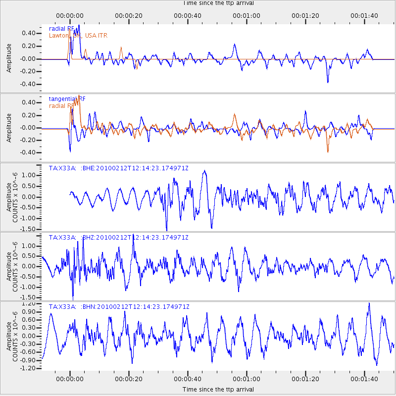
X33A Lawton, OK, USA - Earthquake Result Viewer
*The percent match for this event was below the threshold and hence no stack was calculated.
| Earthquake location: |
Mendoza Province, Argentina |
| Earthquake latitude/longitude: |
-33.6/-68.8 |
| Earthquake time(UTC): |
2010/02/12 (043) 12:03:38 GMT |
| Earthquake Depth: |
148 km |
| Earthquake Magnitude: |
5.6 MB, 5.8 MW, 5.8 MW |
| Earthquake Catalog/Contributor: |
WHDF/NEIC |
|
| Network: |
TA USArray Transportable Network (new EarthScope stations) |
| Station: |
X33A Lawton, OK, USA |
| Lat/Lon: |
34.54 N/98.50 W |
| Elevation: |
346 m |
|
| Distance: |
73.3 deg |
| Az: |
334.714 deg |
| Baz: |
154.421 deg |
| Ray Param: |
$rayparam |
*The percent match for this event was below the threshold and hence was not used in the summary stack. |
|
| Radial Match: |
59.039417 % |
| Radial Bump: |
400 |
| Transverse Match: |
52.54608 % |
| Transverse Bump: |
400 |
| SOD ConfigId: |
306082 |
| Insert Time: |
2010-05-06 07:03:16.021 +0000 |
| GWidth: |
2.5 |
| Max Bumps: |
400 |
| Tol: |
0.001 |
|
Signal To Noise
| Channel | StoN | STA | LTA |
| TA:X33A: :BHZ:20100212T12:14:23.174971Z | 1.9672732 | 6.7562974E-7 | 3.434346E-7 |
| TA:X33A: :BHN:20100212T12:14:23.174971Z | 0.69486684 | 3.6270913E-7 | 5.219837E-7 |
| TA:X33A: :BHE:20100212T12:14:23.174971Z | 1.9015952 | 5.217004E-7 | 2.743488E-7 |
| Arrivals |
| Ps | |
| PpPs | |
| PsPs/PpSs | |


